Welcome to the list of Garmin compatible maps for the United State of America. Click on a row for more info about a given map or filter the list to get exactly what you want.
Filter Results:
You can limit the list below to just maps containing the features you want by checking or unchecking these boxes and hitting Filter:
National forest proposed road/trails for Wilderness and Silver city ranger districts. Best used with NM topo from this site.
View Map Details/DownloadThis routing ATV trail map covers over 5083 miles of legal ATV, UTV and trail bike trails in Maine. This map routes you along trails to your destination with spoken turn by turn directions, visual and audible indications of turns, lists of turn by turn directions, estimated time of arrival (ETA), detouring, route avoidances and precise distance to destination calculations.
View Map Details/DownloadThis routing ATV trail map covers over 4080 miles of legal ATV, ORV and Trail Bike trails in Michigan. In addition, we have added over 7600 miles of DNR Forest roads that are open to ORV use. This map routes you along trails to your destination with spoken turn by turn directions, visual and audible indications of turns, lists of turn by turn directions, estimated time of arrival (ETA), detouring, route avoidances and precise distance to destination calculations. Includes POIs for campgrounds, hotels, gas stations and convenience stores, most with addresses, phone numbers and web site links.
Also available on android devices using the free OsmAnd app.
View Map Details/DownloadThis routing ATV trail map covers over 996 miles of legal ATV, UTV and trail bike trails in New Hampshire. This map routes you along trails to your destination with spoken turn by turn directions, visual and audible indications of turns, lists of turn by turn directions, estimated time of arrival (ETA), detouring, route avoidances and precise distance to destination calculations.
Detailed POI's for on trail services such as parking, food, fuel, lodging and more.
View Map Details/DownloadTrail map of North Higgins Lake State Park.
KMZ File created using Google Earth Pro. Manual Geotag orientation.
View Map Details/Download
This routing ATV trail map covers over 396 miles of legal ATV trails in Lewis County New York. The Adirondacks Tug Hill area is known for snowmobiling in winter has expanded to summer motorsports. This map routes you along ATV and UTV trails to your destination with spoken turn by turn directions, visual and audible indications of turns, lists of turn by turn directions, estimated time of arrival (ETA), detouring, route avoidances and precise distance to destination calculations.
Also available for android devices using the free OsmAnd app.
View Map Details/DownloadThis routing ATV trail map covers over 631 miles of legal ATV and UTV trails in Vermont. This map routes you along trails to your destination with spoken turn by turn directions, visual and audible indications of turns, lists of turn by turn directions, estimated time of arrival (ETA), detouring, route avoidances and precise distance to destination calculations.
View Map Details/DownloadThis routing ATV trail map covers over 2854 miles of ATV, UTV and trail bike trails in West Virginia. This map routes you along trails to your destination with spoken turn by turn directions, visual and audible indications of turns, lists of turn by turn directions, estimated time of arrival (ETA), detouring, route avoidances and precise distance to destination calculations.
Includes all of the Hatfield McCoy trails as well as miles and miles of outlaw trails.
Also available for android devices using the free OsmAnd app.
View Map Details/DownloadCustom map of Philmont Scout Ranch using Open Street Maps data. This map is up-to-date as of January 2023 and uses similar breadcrumbs for trails and tracks as the 2022 Philmont paper maps. See the readme.txt file for installation information for Garmin Base Camp and for copying to Garmin devices. When using in Base Camp, set the detail level to the highest level to see all the map details.
There is no affiliation between this map or account and Philmont Scout Ranch.
View Map Details/DownloadSorry, boydsmaps no longer offers Garmin-format maps for download. However you can access this map (and over 200 others) in the free boydsmaps web app. There's no advertising and no registration, just use the link below to access this map on your computer or phone. See the help function for full documentation of all the other app features.
View Map Details/DownloadSorry, boydsmaps no longer offers Garmin-format maps for download. However you can access this map (and over 200 others) in the free boydsmaps web app. There's no advertising and no registration, just use the link below to access this map on your computer or phone. See the help function for full documentation of all the other app features.
View Map Details/DownloadSorry, boydsmaps no longer offers Garmin-format maps for download. However you can access this map (and over 200 others) in the free boydsmaps web app. There's no advertising and no registration, just use the link below to access this map on your computer or phone. See the help function for full documentation of all the other app features.
View Map Details/DownloadThis is a useful map for amateur radio operators who want to see the maidenhead grid borders for the CONUS.
View Map Details/DownloadGarmin custom map of Acadia National Park with raster image of a USGS 24k topo. Only compatible with the Oregon, Colorado and Dakota series running the newest firmware.
View Map Details/DownloadThe map analyzes all available OSM data to display paved roads separately from unpaved roads; tracks and service roads that are open to motorcycles separately from those that are closed to motorcycles; and track grades, surface warnings, narrow roads, weir crossings, ford crossings, protected areas, footpaths, and steep terrain (as contour lines). The map is intended for adventure motorcycling, both on and off road, but it also works for cars, 4x4s, ATVs, and pedestrians, with the respective Garmin setting. The map does not display mountain bike and bridle trails unless they also permit motorcycles or pedestrians. The map includes an optional overlay of the Trans Australia Trail. There is a contact form on the download page in case of any queries.
View Map Details/DownloadThe map analyzes all available OSM data to display paved roads separately from unpaved roads; tracks and service roads that are open to motorcycles separately from those that are closed to motorcycles; and track grades, surface warnings, narrow roads, weir crossings, ford crossings, protected areas, footpaths, and steep terrain (as contour lines). The map is intended for adventure motorcycling, both on and off road, but it also works for cars, 4x4s, ATVs, and pedestrians, with the respective Garmin setting. The map does not display mountain bike and bridle trails unless they also permit motorcycles or pedestrians. The map includes an optional overlay of the Trans Australia Trail. There is a contact form on the download page in case of any queries.
View Map Details/DownloadThis Transparent map will allow you to add a layer to your GPS showing the boundaries of Big Game Management Units in Alaska. Use the map to see your position relative to Big Game Management Unit boundaries in the field or determine which GMU you are standing in. Turn this layer on and off as needed. Use this transparent map in conjunction with other map products
Updated in 2011
View Map Details/DownloadRoutable map of Arches, Canyonlands, and surrounding area. Trails from NPS and personal tracklogs. Roads from Tiger shape files. Wooded areas from USGS. Contours from USGS 10 meter DEMs. Hydrography from NHD. POI from GNIS. Routing graph generated with GPSMapedit. Compiled with mkgmap.
View Map Details/DownloadThis Transparent map will allow you to add a layer to your GPS showing the boundaries of Big Game Management Units in Arizona. Use the map to see your position relative to Big Game Management Unit boundaries in the field or determine which GMU you are standing in. Turn this layer on and off as needed. Use this transparent map in conjunction with other map products
Updated in 2018
View Map Details/DownloadA 24k quality topo map including contour lines between 10 and 40ft, roads, trails, and high resolution water data for the entire state of Arizona. For mac and windows.
View Map Details/DownloadAn essential tool for your GPS, these fast, intuitive topo maps highlight all public and private property boundaries. Our HUNT maps also add a layer of private land parcels which list land owner information. With this map you can easily determine your position in relation to public or private property boundaries, find new access, determine land owner names and ranch boundaries, and much more!
View Map Details/DownloadTopo map of Arkansas for Garmin GPSr with some overedge.
April 10: Map was revised for the entire State after USGS replaced the gridded elevation data we use to create the contours.
View Map Details/Download-
-
-
-
-
-
-
-
-
-
-
-
-
A JNX format map (for Garmin devices) based on the USGS National Map.
Note you must patch your Garmin firmware to unlock free JNX maps.
View Map Details/DownloadA JNX format map (for Garmin devices) based on the USGS National Map.
Note you must patch your Garmin firmware to unlock free JNX maps.
View Map Details/DownloadGarmin Custom Maps (raster images) including high resolution USGS 24k topo map and NJ 2007 orthophotography. Only compatible with the Garmin Oregon, Dakota and Colorado series running the newest firmware.
View Map Details/DownloadGarmin Custom Maps (raster images) including high resolution USGS 24k topo map and NJ 2007 orthophotography. Only compatible with the Garmin Oregon, Dakota and Colorado series.
View Map Details/DownloadThis expanded Desert Southwest map extends from Yosemite on the west to Joshua Tree on the south, Yellowstone in the north, and stays at Mesa Verde on the east. IT WILL OVERWRITE ANY DESERT SOUTHWEST MAP CURRENTLY ON YOUR SYSTEM. This map is routable, but most of the data has been created by OSM volunteers, so please use it with care.
View Map Details/DownloadGPS'd trails, use trails, camps, and other features for Big Sur California, including Ventana & Silver Peak Wilderness areas and local State Parks. Routable version calculates and displays along-trail route to a destination.
Now updated weekly. Home Page: http://bigsurtrailmap.net
View Map Details/DownloadMap of the Black Forest Trail Loop in Pennsylvania.
The KMZ file uses the official state forest map, geotagged using Google Earth Pro and tiled using KMZFactory
View Map Details/DownloadBlock Management Areas updates for 2023 are now available. This mapset will be updated regularly throughout the hunting season and is a free download from our website.
View Map Details/DownloadHighly detailed pictorial map showing land use and land cover for New Jersey and parts of surrounding states.
View Map Details/DownloadHighly detailed pictorial map showing land use and land cover for New Jersey and parts of surrounding states.
View Map Details/DownloadSorry, boydsmaps no longer offers Garmin-format maps for download. However you can access over 200 maps (including 60 of New Jersey) with the free boydsmaps web app. There's no advertising and no registration, just use the link below. See the help function for full documentation of all the other app features.
View Map Details/DownloadSorry, boydsmaps no longer offers Garmin-format maps for download. However you can access this map (and over 200 others) in the free boydsmaps web app. There's no advertising and no registration, just use the link below to access this map on your computer or phone. See the help function for full documentation of all the other app features.
View Map Details/DownloadOld version of "Boyd's Map of the Pines" only for use in eTrex, GPSMap 60 and other older design units. All others should use "Boyd's Map of New Jersey/GS Edition"
View Map Details/DownloadSorry, boydsmaps no longer offers Garmin-format maps for download. But we do have over 40 maps of New Jersey, many of which are unique and not available anywhere else. They can be accessed with our web app on any type of device - use it like a GPS on your phone or on your computer, the user interface adapts to the screen size. Compatible will all devices and operating systems, it's free with no ads and no registration.
Although the NJ 2007 Landscape map is no longer available, we've processed USGS Annual NLCD data and combined it with 3d terrain for our "Landscape of the United States" series, which includes a total of 40 maps covering the entire US for each year from 1985-2024. You can access these and many more free maps at the link below.
View Map Details/DownloadHighly detailed map of New Jersey and portions of neighboring states, compatible with all Garmin mapping GPS receivers. This is a major update to my previous GS edition map
View Map Details/DownloadColorful and highly detailed map featuring high resolution shaded terrain for the southern half of New Jersey derived from LIDAR imagery. Compatible with all Garmin mapping GPS devices.
View Map Details/DownloadThis is the Bradley Palmer State Park Trail Map that can be imported to a gps unit as a map overlay. It was created originally for a Garmin unit but should be compatible with others.
View Map Details/DownloadRoutable maps of Capitol Reef-North, Bryce Canyon, and Zion National Parks. Map data is from USGS, NHD, Census Bureau Tiger, National Parks Shapefiles, and personal tracklogs. It was compiled with mgkgmap, the OSM compiler. Note: This version replaces one that did not render contours from 7800 ft. to 7400 ft. This was a bug in the compiler. The current map uses an older compiler which renders appropriately.
View Map Details/DownloadGarmin Custom Maps (raster images) including high resolution USGS 24k topo map and NJ 2007 orthophotography. Only compatible with the Garmin Oregon, Dakota and Colorado series running the newest firmware.
View Map Details/DownloadGarmin custom map (raster image) of USGS 24k Topo of Bryce Canyon National Park. ONLY COMPATIBLE WITH THE OREGON, COLORADO AND DAKOTA SERIES GPS RUNNING THE LATEST FIRMWARE.
View Map Details/DownloadVersion 0.08 (May 11, 2009):
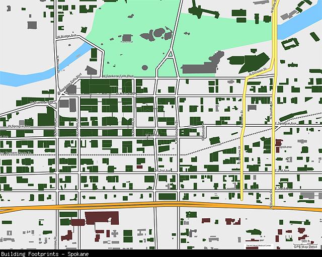
This transparent mapset can overlay other mapsets loaded into your GPS and displays shaded polygons representing the footprints of buildings in cities that have offered this data for public use on their web sites. The cities currently included are:
* Seattle, WA (full coverage, limited differentiation between building types, no building names)
* Spokane, WA (full coverage, no building names)
* Bellevue, WA (full coverage with some overlap into Redmond et al., limited differentiation between building types, few building names)
* Kitsap County, WA (full coverage, limited differentiation between building types, no building names)
* Bellingham, WA (full coverage, limited differentiation between building types)
* Anchorage, AK (no residential buildings)
 View Map Details/Download
-
-
-
-
-
-
-
-
-
-
-
-
-
A JNX format map (for Garmin devices) based on the USGS National Map.
Note you must patch your Garmin firmware to unlock free JNX maps.
View Map Details/DownloadA JNX format map (for Garmin devices) based on the USGS National Map.
Note you must patch your Garmin firmware to unlock free JNX maps.
View Map Details/DownloadA very detailed (20ft contours) topographic map that includes roads and water features and a few trails as well for the entire state of California. This is a release of Laura's map that allows for a MapSource install so older Garmin units can use the maps and so it can be combined with other maps.
View Map Details/DownloadTrails and dirt roads on public land in all of southern California, central California and Clark county Nevada.
Upper boundary is Reno, Nevada.
Counties included: Amador, Calaveras, Clark(nv), El Dorado, Fresno, Imperial, Inyo, Kern, Kings, Los Angeles, Madera, Mariposa, Mono, Monterey, Orange, Placer, Riverside, Sacramento, San Benito, San Bernardino, San Diego, San Joaquin, San Luis Obispo, Santa Barbara, Santa Clara, Tulare, Tuolumne and Ventura.
Portions of Carson City, Douglas, Esmeralda, Lyon, Mineral, Nye and Washoe counties in Nevada
Trails are color coded to indicate if regulations permit hiking, biking, horseback or off-roading. Trail data is exclusive and thorough.
Three map backgrounds are included: Topo, Transparent and Public Land Agency
42,665 miles of non-motorized trails. (3,000 miles in Nevada)
54,715 miles of motorized dirt roads and OHV trails. (8,000 miles in Nevada)
California:
Angeles National Forest
Anza-Borrego Desert State Park
BLM Lands
California City
Carrizo Plain National Monument
Cleveland National Forest
Channel Islands
Death Valley National Park
Dove Springs
Dumont Dunes
Eldorado National Forest
Humboldt-Toiyabe National Forest
Imperial Sand Dunes
Inyo National Forest
Jawbone Canyon OHV Area
Johnson Valley OHV Area
Joshua Tree National Park
Lake Morena
Los Padres National Forest
Mammoth
Mojave National Preserve
Ocotillo Wells SVRA
Plaster City
Red Rock Canyon State Park
San Bernardino National Forest
San Jacinto Mountains
Santa Monica Mountains
Sequoia & Kings Canyon National Park
Sequoia National Forest
Sierra National Forest
Spangler Hills OHV Area
Stanislaus National Forest
Stoddard Valley OHV Area
Superstition
Yosemite
Nevada:
Ash Meadows National Wildlife Refuge
Desert National Wildlife Refuge
Humboldt-Toiyabe National Forest(south)
Lake Mead NRA
Lake Tahoe
Logandale Trails
Red Rock Canyon
Valley of Fire State Park
Includes all dirt roads west of Hwy 95 in Esmeralda and Nye counties.
*** See Facebook Reviews ***
View Map Details/DownloadPRODUCT OVERVIEW:
An essential tool for your GPS, these fast, intuitive topo maps highlight all public and private property boundaries With this map you can easily determine your position in relation to public or private property boundaries, find new access, enjoy 24K topo, locate hunting unit boundaries, and we are just getting started! Endorsed by numerous State and Federal agencies, our maps are the most reliable source for land ownership maps on the market.
Map Key Features
Have the confidence in the field to be a better hunter and make ethical decisions. Our Maps have the same look and feel as standard BLM maps but with additional features:
- Color coded public and private lands
- 24K topographic functionality
- Section lines and numbers
- Roads (hwy, city, back-roads, trails)
- Water data (lakes, rivers, creeks, springs)
- National Forest roads and trails
- Geographic features and names
- Game Management or Hunting Units
- State specific features (WMA, WPA, CWMU)
onXmaps web page for California
NOTE: Regional Maps DO NOT HAVE Land Owner Names
- Discover little-known, seldom-hunted public land.
- Navigate confidently around private lands you're not allowed to hunt.
- Easily identify big game hunting unit boundaries.
View Map Details/Download
Here is a map of Catoctin Mountain Park (US Park), the home of Camp David, the Presidential retreat. Near by is Maryland's Cunningham State Park. The area contains many hiking trails that lead to great water features and vistas.
Image Tiles: 6 tiles
Size: 556K
Georeference Accruacy: Good, but not perfect (slight flaws in Park Map)
Resolution: 6 meters per pixel
Clarity/readability Range: 0.3mi down to 500ft
Visible Level Range: 1.2mi down to 120ft
Draw Order Setting: 50
View Map Details/DownloadGarmin Custom Map featuring very high resolution orthophotography of Center City Philadelphia, PA. Only compatible with the Oregon, Colorado and Dakota series running the newest firmware.
View Map Details/DownloadRaccoon Mtn., Booker T. Washington St. Park, Enterprise South Nature Park, and Chattanooga, TN River Walk - mountain bike trails.
View Map Details/DownloadThis mapset is for Garmin Oregon/Colorado/Dakota GPS users who have City Navigator maps and want to navigate at night without glare. Enable this map when the sun goes down for a Night Mode similar to the Nuvi's.
View Map Details/Download
-
-
-
-
-
-
-
-
-
-
-
-
-
A JNX format map (for Garmin devices) based on the USGS National Map.
Note you must patch your Garmin firmware to unlock free JNX maps.
View Map Details/DownloadA JNX format map (for Garmin devices) based on the USGS National Map.
Note you must patch your Garmin firmware to unlock free JNX maps.
View Map Details/DownloadAerial images from 2007 2 foot per pixel - USGS High Resolution State Orthoimagery - Pennsylvania South Cental Counties (Limited to Codorus Area)
Source: The aerial images were obtained from the National Map Seamless Map Server (2007 2 foot per pixel - USGS High Resolution State Orthoimagery - Pennsylvania South Cental Counties) and coverted using G-Raster software. Images come georeferenced in geotiff format).
View Map Details/DownloadCodorus State Park Map (Pennsylvania). The 3,452-acre Codorus State Park is in the rolling hills of southern York County. The 1,275-acre Lake Marburg has 26 miles of shoreline and is a reststop for migrating waterfowl and shorebirds. The park is is stocked full with Geocaches. The lake is also popular with sailboaters and motorboaters. Anglers love the lake for warm water fishing and can also fish Codorus Creek for trout. Picnicking, swimming in the pool and camping are popular activities.
Image Tiles: 9 tiles
Size: 33MB
Georeference Accruacy: Very Good - Trails are approximate
Clarity Level Range: 0.2mi down to 200ft
Draw Order Setting: 49
View Map Details/DownloadThe purpose of this map is to have electronic maps of the Colorado 4WD Trails for Garmin GPS units (with mapping capability).
View Map Details/DownloadThis Transparent map will allow you to add a layer to your GPS showing the boundaries of Big Game Management Units in Colorado. Use the map to see your position relative to Big Game Management Unit boundaries in the field or determine which GMU you are standing in. Turn this layer on and off as needed. Use this transparent map in conjunction with other map products.
Now Updated to 2018
View Map Details/Download-
-
-
-
-
-
-
-
-
-
-
-
-
This Transparent map will allow you to add a layer to your GPS showing the Migration Routes for many Big Game Species. Turn this layer on and off as needed.
Updated for 2018!
View Map Details/DownloadThis transparent map will allow you to add a layer to your GPS showing the boundaries of Bighorn Management Units in Colorado. Use the map to see your position relative to Bighorn Game Management Unit boundaries in the field or determine which GMU you are standing in. Turn this layer on and off as needed. Use this transparent map in conjunction with other map products.
Updated in 2018
View Map Details/DownloadThis transparent map will allow you to add a layer to your GPS showing the boundaries of Mountain Goat Management Units in Colorado. Use the map to see your position relative to Mountain Goat Game Management Unit boundaries in the field or determine which GMU you are standing in. Turn this layer on and off as needed. Use this transparent map in conjunction with other map products.
Updated in 2018
View Map Details/DownloadComplete topographic map of Colorado including extensive 4WD roads, high resolution water data, land use, 40ft contours, and points of interest. Equivalent to a 24k topo.
View Map Details/DownloadSorry, this map has been discontinued and boydsmaps no longer supports Garmin format maps. But try our new web app at boydsmaps.com. Use it as a GPS on your phone or use the desktop version on your computer. Like all my maps, it's free, there's no advertising and no registration required.
View Map Details/Download1:24000 raster topo map of Coyote Buttes and area to the West of Page, Arizona that would be of interest to photographers/hikers. Created by John Hollenberg with Moagu and data downloaded from scanned topos on the USGS seamless server.
View Map Details/DownloadGarmin custom map (raster image) of USGS 24k Topo of Crater Lake National Park. ONLY COMPATIBLE WITH THE OREGON, COLORADO AND DAKOTA SERIES GPS.
View Map Details/DownloadNewly Updated! Download over 55 custom waypoint icons specifically designed for hunting in the west. now you'll be able to mark your bull or cow elk with an actual bull or cow elk symbol. There is also deer, bighorn sheep, bear, wolf, moose, animal tracks, blood trail, and much more! Compatible with most new and older generation Garmin mapping GPS units! The free download, screenshots, and instructions can be found on the website!
View Map Details/DownloadGarmin Custom Map of the Delaware Water Gap area featuring a USGS 24k topo raster image. Only compatible with the Oregon, Colorado and Dakota series running the newest firmware.
View Map Details/DownloadCarl Dubler released maps of two areas in Denver: South Suburban and Highlands Ranch Trail Maps. They are available for free for your Garmin GPS as well as for Microsoft Trips & Streets and Google Earth.
From Carl: "The goal is to make using these trails easier and more enjoyable, particularly for geocaching. Carl plans to map all the trails in the Denver metro area, starting with the ones nearest his home in the South Suburban Parks and Recreation District."
View Map Details/DownloadThis mapset shows the Township Range and Section your in for the entire state of Montana. If you do field work or work for an agency this mapset will prove handy to have in the field!
View Map Details/Download.gpi (POI) file with two databases: 1) Home search by NAME, and 2) Home search by ADDRESS. Only for Montana.
View Map Details/Download
-
-
-
-
-
-
-
-
-
-
-
-
-
The Montana Forest Cover transparent overlay (by Yogamaps) has been extracted from the 2012 GAP habitat analysis. This map shows you areas of dense forest cover (what animals would consider "secure habitat") across the entire state of Montana. It will also show you the name of the dominant species and is colorized differently for different dominant species. Use this map to help plan your outdoor adventures or to help execute your hunting strategies!
Please visit our site for screenshots and download details!
View Map Details/DownloadMaximize your fishing strategy by downloading this transparent overlay mapset for Garmin GPS units containing underwater topographic lines for over 500 lakes in Montana. Based on lake bathymetry data from Montana Fish, Wildlife, & Parks. For screenshots and a list of lakes included in this mapset please see our website!
View Map Details/DownloadThe MT Topo + Forest Cover 2018 basemap contains our topo, road, and point of interest data combined with areas of forest cover. We've broken forest cover into two types, 15-50% canopy cover (shows as light green) and 50-99% canopy cover (shows as a darker green). But we didn't stop there! We've added special coloration for forest areas within USGS Geomac fire polygons. Drop a map pin within a fire polygon and you'll see the year it burned! Great info for determining habitat and succession stage in your hunting areas!
This mapset can be purchased separately or can be bundled with other maps in our Hunting & Fishing Combo map package.
View Map Details/DownloadRoutable map of Southern UT, Northern AZ, and Eastern NV. Topo, hydrography, and wooded areas from USGS. Roads, POI and trails from OpenStreetMap and my personal tracklogs. Land ownership and park boundaries from BLM state office files. National Parks included: Arches, Canyonlands, Capitol Reef, Bryce, Zion, Grand Canyon, Petrified Forest, and Great Basin.
View Map Details/DownloadEast Fort Rock OHV Trail System
Garmin Routable map which is color coded the same as the typical pdf file available onlne. This should be a transparent map so you should be able to overlay it on your topo's. I searched high and low for gps data on this trail network to no avail. Decided to make my own though everyone says the trails are well marked, there is nothing like being able to see your selected route highlighted or hearing turn by turn directions. I used the GIS data available online from the Deschutes National Forest Service, processing through probably 4 or 5+ different programs. So anyone who uses it please let me know the acurracy or problems, as I hope to get out there for the first time this summer.
View Map Details/DownloadTransparent trails map for the back country area east of Reno, NV. Designed for use by SxS (RZR & Rhino), ATV and lifted specialty Jeeps. Maps are graded by color according to difficulty. Extends from I-80 south to Dayton & Carson city; includes Virginia City and east Washoe Valley.
View Map Details/DownloadTransparent Garmin overlay map showing the close approximate path, centerline, and boundaries of the total solar eclipse of April 08, 2024.
View Map Details/DownloadTransparent Garmin overlay map showing the close approximate path, centerline, and boundaries of the annular solar eclipse of October 14, 2023.
View Map Details/DownloadTransparent overlay map showing the close approximate path, centerline, and boundaries of the total solar eclipse of August 21, 2017.
View Map Details/DownloadThis gravitational model is complete to spherical harmonic degree and order 2159, and contains additional coefficients extending to degree 2190 and order 2159.
View Map Details/Download-
-
-
-
-
-
-
-
-
-
-
-
-
THIS MAP HAS BEEN DEPRICATED. If you're still interested in obtaining it, email me. Thanks
Elk Slope-Cover v4(overlay) is derived from 10 meter digital elevation data. We based this model on data that shows elk seem to prefer sloped terrain between 15%-30% and secure forest cover with a canopy of 75-99%. We clipped the slope data to include only areas of >75% canopy cover where elk seek secure shelter from weather and predators. Whether you're a novice hunter or a seasoned veteran of elk country, this elk slope-cover model will allow you to view the landscape in a whole new way.
The Elk Slope Preference model overlay comes bundled in our Hunting & Fishing Combo mapset.
View Map Details/DownloadEnterprise South Nature Park in Chattanooga, TN. This is the paper map of trails for mtn. biking, hiking, jogging, and a designated trail for individuals with physical impairments. This map can only be displayed on Garmin units capable of displaying "Garmin Custom Maps".
View Map Details/DownloadA 24k quality topo map including 5ft contours lines, roads, trails, high resolution water data, and special Florida items such as bathymetric data for the entire state of Florida for your Garmin GPS unit. For mac and windows.
View Map Details/DownloadGarmin Custom Maps (raster images) including high resolution USGS 24k topo map and NJ 2007 orthophotography. Only compatible with the Garmin Oregon, Dakota and Colorado series.
View Map Details/DownloadRaster map of French Creek State Park. Including trails, roads, points of interest, etc. This map is created from the official PDF map of the park and then converted to .kmz by GRaster.
View Map Details/DownloadGarmin Custom Map (GoogleEarth-compatable) version of official park map - 49 tiles, ~1.4m resolution
View Map Details/DownloadThis download contains a Garmin POI file with the locations and descriptions of Geodetic Control Points in Montana and Idaho.
View Map Details/DownloadProposed road/trails for Wilderness and Silver City Ranger districts. All exist at present, some proposed for only ATV, some to be closed. This works well with the NM Topo from this site.
View Map Details/Download2016 GPS SledMap USA map for Garmin GPS units is ready! You get Michigan, Wisconsin, Minnesota, North Dakota, New York, Maine, and New Hampshire for $10 less than last year! We continue to add and update trails each year and our 2016 map is no exception. Routable map with turn by turn directions.
View Map Details/DownloadGPS Trailmasters, the leading provider of up to date off road maps in New England has just what you need for your next adventure in the State of Maine.
With roughly 7,000 miles of ATV trails - many of which are interconnected - the State of Maine has so much to offer! Take a multi-day trip from Downeast Maine to the Allagash. Find all your food, lodging, and fuel along your way using this auto-routing map. Our map pairs with most Garmin GPS units and is packed with hundreds of points of interest. Spend more time exploring Maine's vast trail system and less time looking for places to ride and park. Use this GPS trail map anywhere within the state of Maine. Explore areas such as Aroostook County, Jackman, Greenville, Eustis, and popular trail systems like the Down East Sunrise Trail.
We have routable maps for your Garmin GPS! Need something for Ride Command or your smartphone? We have what you need!!
View Map Details/DownloadGPS Trailmasters, the leading provider of up to date off road maps in New England has just what you need for your next adventure in the State of Maine.
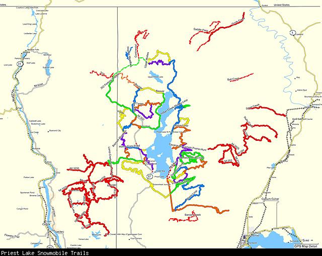
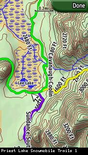
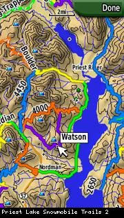
For the snowmobiler that wants to enjoy all Maine has to offer, this Maine snowmobile GPS trail map should be your top priority. With almost 11,000 miles of trail covering club trails, state ITS trails, access trails, and connectors, you can go exploring with confidence! Auto-route your way from Lake Parlin to Pittston Farms. Search the POI database for hard-to-find attractions such as the Grand Falls, Coburn Mountain, the B-52 crash site on Elephant Mountain, the Trains of Eagle Lake, and the must see Chesuncook lake house. This ME GPS snowmobile trail map covers groomed snowmobile trails across the entire state, including popular destinations like "The County", Eustis, Jackman, Millinocket, Rangeley, the Forks and Shin Pond.
We have maps for your Garmin GPS, Polaris Ride Command & Apple/Android devices!
View Map Details/DownloadGPS Trailmasters, the leading provider of up to date off road maps in New England has just what you need for your next adventure.
With almost 11,000 miles of trail, this GPS trail map is for the serious ATVer. Covering Maine, New Hampshire, Vermont, New York, and Pennsylvania, this comprehensive routable ATV map pairs perfectly with your Garmin GPS. This map is packed with hundreds of on trail services such as fuel, food, and lodging. With all the same points of interest and trails as each individual state map, this map is the best bang for your buck if you ride multiple states!
In addition to routable Garmin maps we also carry a full line of maps for your Polaris Ride Command and Apple/Android devices!
View Map Details/DownloadGPS Trailmasters, the leading provider of up to date off road maps in New England has just what you need for your next adventure!
If you're the die-hard rider that regularly crosses the borders and takes multi-day snowmobile trips, this map is for you! This is our best value US snowmobile GPS map. We have combined over 34,000 miles of snowmobile trails across Maine, New Hampshire, Vermont, New York and Pennsylvania and created a trail map overlay for your Garmin GPS. This GPS trail map includes the same number of trails and points of interest and the same detail as the individual state maps but is offered at a discounted price over buying multiple state maps. Club, corridor, state ITS trails, and connectors are all included in this map. Explore new areas and do it with confidence!
In addition to our Garmin routable maps we also have maps for your Apple/Android phones and Ride Command!
View Map Details/DownloadGPS Trailmasters, the leading provider of up to date off road maps in New England has just what you need for your next adventure in the New Hampshire!
If you are excited about riding in New Hampshire this map is a must! With New Hampshire's roughly 1,000 mile interconnected ATV trail systems throughout the beautiful Great North Woods you can enjoy spectacular views and terrain for all ability levels. Enjoy the safety and convenience of knowing where you are when exploring New Hampshire's finest trails. This New Hampshire ATV GPS trail map covers over 1,100 miles of ATV trails across the southern portion of the state, and areas in the north that include the popular Jericho State Park in Berlin, Success, Pittsburg, North Stratford, Groveton, and Lancaster. Use this map to plan your weekend ride and track your journey having the confidence of knowing where you are at all times.
With maps for your Garmin GPS, Polaris Ride Command and Apple/Android phones we have what you need for your adventure!
View Map Details/DownloadGPS Trailmasters, the leading provider of up to date off road maps in New England has just what you need for your next adventure in New Hampshire!
Whether you are brand new to the sport or a seasoned rider, we have the snowmobile GPS trail map you need! With over 4,700 miles of trail, this map will get you where you need to go! There is no better way to navigate the trails and explore the Lakes Region that includes Sunapee, Newfound, Winnisquam and the massive Lake Winnipesaukee. Take an afternoon to ride a local club system in southern NH or the popular snowmobile trail systems in the great north woods. This map is packed with points of interest including on trail food, fuel, and lodging.
We have auto-routing maps for your Garmin as well as maps for your Polaris Ride Command and smartphones!
View Map Details/DownloadGPS Trailmasters, the leading provider of up to date off road maps in New England has just what you need for your next adventure in New York!
For your New York off-road adventure! Enjoy scenic views and backwoods riding at its best. Ride with the convenience of knowing where you are while exploring the trails. This New York ATV GPS trail map currently covers the Tug Hill/Lewis County ATV Trail system and Tall Pines with plans in Spring 2022 to expand to include several public trail systems and private parks.
With maps for Garmin GPS units, Smartphones & Ride Command, we have something for everyone!
View Map Details/DownloadGPS Trailmasters, the leading provider of up to date off road maps in New England has just what you need for your next adventure in New York!
Our New York snowmobile GPS trail map contains almost 12,000 miles of trails including the ever popular Old Forge & Tug Hill region as well as hundreds of gas, food, and lodging points of interest! This map overlay of the New York state snowmobile trail system for your Garmin GPS will give you comfort on the trails knowing exactly where you are and where you are going at all times. This auto-routing map gives turn-by-turn directions to your destination. Whether you're cruising to your destination or need to find the nearest gas or food, this expansive map includes snowmobile trails across the state and is a must have for any serious rider.
We have maps for all your devices! We have turn by turn maps for your Garmin GPS units and non-routable maps for your Apple/Android devices and Ride Command!
View Map Details/DownloadGPS Trailmasters, the leading provider of up to date off road maps in New England has just what you need for your next adventure in Pennsylvania!
This Pennsylvania ATV trail map is being introduced into our product line for the 2021 ATV season containing close to 1,000 miles of trails for the Anthracite Outdoor Adventure Area (AOAA), the Snow Shoe Rails To Trails, Bloody Skillet & Whiskey Springs (including the connector), Elk Country, CMATVA, Lost Trails and Haneyville. Watch for updates in early 2022 to include all state parks!
We have maps for your Garmin GPS units, Polaris Ride Command and Apple/Android phones!!
View Map Details/DownloadGPS Trailmasters, the leading provider of up to date off road maps in New England has just what you need for your next adventure in Pennsylvania!
Our Pennsylvania GPS snowmobile trail map contains over 3,300 miles of trails including state parks and local club trails. This quickly expanding map covers the Pennsylvania Wilds Area - North Central snowmobile trails, Potter County snowmobile club, Lyman Run State Park, Cherry Springs State Park, Ole Bull State Park, Leetonia, Hyner Run and Hyner View State Parks, the Allegheny National Forest, and Saint Mary�¢??s Snowmobile Association trails. Explore the trails in Pennsylvania with the confidence of knowing where you are going, where your next fuel stop is and how to get back to camp!
We have maps for all your devices! Need a routable Garmin map? No problem!! Looking for something for your Polaris Ride Command or Apple/Android phone? No problem!!
View Map Details/DownloadGPS Trailmasters, the leading provider of up to date off road maps in New England has just what you need for your next adventure in the State of Vermont.
With almost 1,100 miles of ATV trails in Vermont, you are sure to find something for every rider. From mountain passes to leisurely dirt road riding, Vermont has it all! Whether you are camping at one of the many campgrounds on the trail system or just going for an afternoon, you can find comfort in knowing exactly where you are at all times. This overlay works on most Garmin GPS units and is packed with points of interest including parking areas, scenic views, fuel stations, restaurants, and other trail side services.
We also have maps available for your Ride Command and Apple/Android devices!
View Map Details/DownloadGPS Trailmasters, the leading provider of up to date off road maps in New England has just what you need for your next adventure in the State of Vermont.
This Vermont snowmobile trail map covers over 4,000 miles of trail in this beautiful state. This GPS trail map is packed with points of interest including scenic views, fuel stations, restaurants, lodging, and other trail side service. Enjoy the added safety and convenience of knowing exactly where you are at all times. Head to Island Pond for a day, ride up to Newport or head to Southern VT. This comprehensive statewide map covers all these areas and everything in between! This is just what you need to plan your next big trip!
With maps for your Polaris Ride Command, Garmin GPS and smartphones GPS Trailmasters has you covered!
View Map Details/DownloadCovers all of Illinois, Indiana, Michigan, Ohio, Pennsylvania, and Wisconsin!
PRODUCT OVERVIEW:
An essential tool for your GPS, these fast, intuitive topo maps highlight all types of public lands. With this map you can easily determine your position in relation to public or private property boundaries, find new access, enjoy 24K topo, locate hunting unit boundaries, and we are just getting started! Endorsed by numerous State and Federal agencies, our maps are the most reliable source for land ownership maps on the market.
Map Key Features
Have the confidence in the field to be a better hunter and make ethical decisions. Our Maps have the same look and feel as standard BLM maps but with additional features:
- Color coded public and private lands
- 24K topographic functionality
- Section lines and numbers
- Roads (hwy, city, back-roads, trails)
- Water data (lakes, rivers, creeks, springs)
- National Forest roads and trails
- Geographic features and names
- Game Management or Hunting Units
- State specific features (WMA, WPA, CWMU)
onXmaps web page for Plains Regional Map
NOTE: Regional Maps DO NOT HAVE Land Owner Names
- Discover little-known, seldom-hunted public land.
- Navigate confidently around private lands you're not allowed to hunt.
- Easily identify big game hunting unit boundaries.
View Map Details/Download
Garmin Custom Maps (raster images) including high resolution USGS 24k topo map and NJ 2007 orthophotography. Only compatible with the Garmin Oregon, Dakota and Colorado series running the newest firmware.
View Map Details/DownloadTrail map for the West Virginia OHV Hatfield-McCoy Trails. More information available at http://www.trailsheaven.com/
View Map Details/DownloadA 24k quality topo map including 30ft contours lines, roads, trails, points of interest, and high resolution water data for the entire state of Hawaii. For mac and windows.
View Map Details/DownloadHelena National Forest official travel map draped over a 10 meter digital elevation model AND a mapset without terrain shading. This is a custom map for newer garmin handhelds.
View Map Details/DownloadA total US street map based on the 2007 census data. This map is free, and I intend for it to remain so. GPSFileDepot offers an exclusive mac version for download.
View Map Details/DownloadThis Transparent map will allow you to add a layer to your GPS showing the boundaries of Big Game Management Units in Idaho. Use the map to see your position relative to Game Management Unit boundaries in the field. Turn this layer on and off as needed. Use this transparent map in conjunction with other map products such as our BLM4GPS state maps, Topo USA, or a preloaded Topo Basemap.
Now Updated to 2018
View Map Details/DownloadThis transparent map will allow you to add a layer to your GPS showing the boundaries of Elk Management Units in Idaho. Use the map to see your position relative to Elk Game Management Unit boundaries in the field or determine which GMU you are standing in. Turn this layer on and off as needed. Use this transparent map in conjunction with other map products.
Updated in 2018
View Map Details/DownloadA 24k quality topo map including contours lines, roads, trails, points of interest, and high resolution water data for the entire state of Idaho. For mac and windows.
View Map Details/DownloadA 24k quality topo map including 10ft contours lines, roads, trails, and high resolution water data for the entire state of Illinois for your Garmin GPS unit. For mac and windows.
View Map Details/DownloadIntroduction
This transparent map will allow you to add a layer to your GPS unit showing the boundaries of wilderness areas in Illinois. Use the map to see your position relative to wilderness boundaries in the field. You can use this map in conjunction with other maps, such as topo maps, you may have on your GPS unit already.
Installation
PC Version
- Clicking on the link above downloads and runs the installer (.exe), which unzips the appropriate files to your computer and registers them with MapSource.
MAC Version
- Clicking on the link above downloads a zip file (.zip). Unpack this zip file using Stuffit Expander (or something similar), then double-click the .gmapi file. MapManager should launch and a window should open up that says "Install these maps?". Click the install button and the map will be installed into Basecamp.
Version and Updates
The map version date is displayed on the initial installation screen. Maps are updated whenever new wilderness areas are added to the National Wilderness Preservation System or when older boundaries are revised.
Follow us on Twitter to make sure you receive announcements about updated maps. To update to the current version of this map, uninstall the older version (use the “Uninstall” utility in the folder where you installed the maps the first time) before downloading and installing the current version from the links provided.
Data Source
The data used to compile this map comes from the federal wilderness management agencies (Bureau of Land Management, Fish and Wildlife Service, Forest Service, and National Park Service) and is maintained by the University of Montana's Wilderness Institute through
http://www.wilderness.net.
Contact Information
Please contact Lisa Eidson, Wilderness Information Specialist and Webmaster for Wilderness.net, with any questions or concerns:
[email protected], 406-243-6933 (office), 406-396-3607 (cell).
View Map Details/DownloadGarmin custom map of Island Beach State Park featuring high resolution NJ 2007 orthoimagery. Only compatible with the Oregon, Colorado and Dakota series running the newest firmware.
View Map Details/DownloadJordan Valley Pathway hiking map. Includes a portion of the North Country Trail.
Custom KMZ map overlay file using the Michigan DNR official trail map.
KMZ file geo-oriented manually using Google Earth Pro. The image has been tiled into a 6x8 grid of images using KMZFactory for high detail resolution.
View Map Details/Download1:24000 raster topo map of Joshua Tree National Park and surrounding area. Created by John Hollenberg with Moagu and data downloaded from scanned topos on the USGS seamless server.
View Map Details/DownloadGarmin Custom Map of Kauai, HI featuring USGS 24k topo raster imagery. Only compatible with the Oregon, Colorado and Dakota series running the newest firmware.
View Map Details/DownloadHere is a map for Kings Gap Environmental Education Center located in Pennsylvania.
Image Tiles: 9
Size: 2.89MB
Georeference Accruacy: Very Good
Clarity Level: Down to 120 feet
Draw Order Setting: 50
View Map Details/DownloadGarmin custom map (raster image) of USGS 24k Topo of the Lassen Volcanic National Park. ONLY COMPATIBLE WITH THE OREGON, COLORADO AND DAKOTA SERIES GPS.
View Map Details/DownloadSorry, boydsmaps no longer offers Garmin-format maps for download. However you can access this map (and over 200 others) in the free boydsmaps web app. There's no advertising and no registration, just use the link below to access this map on your computer or phone. See the help function for full documentation of all the other app features.
View Map Details/DownloadSorry, boydsmaps no longer offers Garmin-format maps for download. However you can access this map (and over 200 others) in the free boydsmaps web app. There's no advertising and no registration, just use the link below to access this map on your computer or phone. See the help function for full documentation of all the other app features.
View Map Details/DownloadSorry, boydsmaps no longer offers Garmin-format maps for download. However you can access this map (and over 200 others) in the free boydsmaps web app. There's no advertising and no registration, just use the link below to access this map on your computer or phone. See the help function for full documentation of all the other app features.
View Map Details/DownloadSorry, boydsmaps no longer offers Garmin-format maps for download. However you can access over 200 maps (including 60 of New Jersey) with the free boydsmaps web app. There's no advertising and no registration, just use the link below to get started. See the help function for full documentation of all the other app features
View Map Details/DownloadA detailed map of Mackinac Island State Park. Including paths, roads, points of interest, etc. This map type is for use with the Garmin Oregon, Dakota and Colorado models. This is my first map and it has not been tested. I welcome any feedback. Thank you.
View Map Details/DownloadFor the snowmobiler that wants to enjoy all Maine has to offer, this Maine snowmobile GPS trail map should be your top priority. Go exploring with confidence and auto-route your way from Lake Parlin to Pittston Farms. Search the POI database for hard to find attractions such as the Grand Falls, Coburn Mountain, the B-52 crash site on Elephant Mountain, the Trains of Eagle Lake and the must see Chesuncook lake house. This ME GPS snowmobile trail map covers thousands of miles of groomed snowmobile trails across the entire state, including popular destinations like �¢??The County�¢??, Eustis, Jackman, Millinocket, Rangeley, the Forks and Shin Pond.
Examine our Maine snowmobile trail map for your favorite riding area and read about our GPS maps to see Garmin screenshots of the different trail colors and styles. Get the most from your purchase with our cross platform X Package.
Map is available as a transparent layer or with background map.
View Map Details/Download* Contour lines (40' interval)
* Street names, rail roads
* Lakes, ponds and streams
* Federal lands
* State and counties border
* Apalachian trail
* Fixed contour lines error
View Map Details/DownloadKMZ file of the Manistee River Trail Loop, which includes part of the North Country Trail.
The file uses 2 maps created by NCT and was Geotagged using Google Earth Pro and tiled using KMZFactory
View Map Details/DownloadState of Massachusetts topo map with contour line, counties and state boundary, roads, water, federal land, and other data. Compatible with both PC & Mac.
View Map Details/DownloadPRODUCT OVERVIEW:
An essential tool for your GPS, these fast, intuitive topo maps highlight all types of public lands. With this map you can easily determine your position in relation to public or private property boundaries, find new access, enjoy 24K topo, locate hunting unit boundaries, and we are just getting started! Endorsed by numerous State and Federal agencies, our maps are the most reliable source for land ownership maps on the market.
Map Key Features
Have the confidence in the field to be a better hunter and make ethical decisions. Our Maps have the same look and feel as standard BLM maps but with additional features:
- Color coded public and private lands
- 24K topographic functionality
- Section lines and numbers
- Roads (hwy, city, back-roads, trails)
- Water data (lakes, rivers, creeks, springs)
- National Forest roads and trails
- Geographic features and names
- Game Management or Hunting Units
- State specific features (WMA, WPA, CWMU)
onXMaps web page for Midwest Regional Map
NOTE: Regional Maps DO NOT HAVE Land Owner Names
- Discover little-known, seldom-hunted public land.
- Navigate confidently around private lands you're not allowed to hunt.
- Easily identify big game hunting unit boundaries.
View Map Details/Download
Map Boundary:
North: 49°
South: 37°
West: -109°
East: -93°
Country: United States
States: All of Colorado, Kansas, Nebraska, North Dakota, and South Dakota
Parts of Iowa, Minnesota, Missouri, Montana, and Wyoming
Price: Free
Map Features:
Topographic Data
Street Data
* Roads - Interstates, highways, arterial roads, residential roads, limited unpaved roads
* Railroads
* High resolution water data - lakes, rivers, streams, and washes
* Federal Land Usage - Wilderness area, national parks, and military bases/ranges, native american reservations
* Borders - County and state boundary lines
* Elevation contours - 20ft intervals
* GNIS Points of Interest - summits, mines, falls, dams, cemeteries, towers, populated places, etc.
* 4 Grid Segments to the dergee - no segment larger than 5.7mb most less then 2mb in size
View Map Details/DownloadThis Garmin GPS map-set contains lake-depth contour maps of many
many hundreds of Minnesota USA lakes. 1159 lakes to be exact.
With 5ft. to 20ft. contours-intervals being typical. Some shallow
lakes and bays having even smaller contour intervals of 1 ft.
This is a transparent map so you may load it into your GPS unit
along with other maps and then using your GPS device's "Map
Setup" options to Show or Hide it overlaid on your other map-
sets. It works particularly well when used in conjunction with
the free high-resolution Minnesota 24K Topo map from
www.gpsfiledepot.com. With this lake-depth map being transparent
it then allows all the contour lines of all islands from the topo
map to show through properly.
View Map Details/DownloadCustom mapset of OHV (Off Highway Vehicles) trails in the state of Minnesota. OHVs include ORVs (Off Road Vehicles), OHMs (Off Highway Motorcycles) and ATVs (All Terrain Vehicles). This is a work in progress - trails are added as data is obtained.
View Map Details/DownloadA snowmobile trail map that also includes roads and water features. From the author:
"The map covers most, if not all, of the major trails across the entire state, plus some smaller ones that either I've collected or people have been kind enough to send me data for. There are quite a few new trails on this map as well as markings for many shelters and businesses. These businesses include gas stations, restaurants, resorts and motels, and parts/service shops."
View Map Details/DownloadSHOP NOW ON THE HUNT BY ONXMAPS WEBSITE!
HUNT Map Product Overview
An essential tool for your GPS, these fast, intuitive topo maps highlight all public and private property boundaries. Our HUNT maps also add a layer of private land parcels which list land owner information. With this map you can easily determine your position in relation to public or private property boundaries, find new access, determine land owner names and ranch boundaries, and much more! Endorsed by numerous State and Federal agencies, our maps are the most reliable source for land ownership maps on the market.
- Discover little-known, seldom-hunted public land in Minnesota
- Pinpoint private land owners by parcel so you can request access
- Navigate around private lands you're not allowed to hunt
- Easily identify big game hunting unit boundaries
- View road & trail data to help you navigate
HUNT Map Key Features
- Land owner names with property boundaries. View our Plat Coverage Map for more information
- Color-coded public and private lands
- 24K topographic functionality
- Section lines and numbers
- Roads (hwy, city, back-roads, trails)
- Water data (lakes, rivers, creeks, springs)
- National Forest roads and trails
- Geographic features and names
- Hunting Zone Boundaries
- State specific features (WMA, WPA, CWMU, etc.)
SHOP NOW FOR HUNT MINNESOTA!
View Map Details/Download
A 24k quality topo map including 10ft contours lines, roads, trails, points of interest, and high resolution water data for the entire state of Mississippi. For mac and windows.
View Map Details/DownloadI have just updated this map to version 3.0.
Major changes are:
Added 25+ new tracks.
Added 40+ new wpts.
Added a lot of trail parking/staging areas.
Modified and improved wpt symbols on map.
Improved accuracy of several tracks.
Added Hwy 191 & 313.
Added boundaries of Dead Horse Point State Park.
This is a self-installing transparent map of a 1000 miles and 138 of the most popular trails in the Moab area. It has 312 waypoints, including Trailheads, obstacles, scenic overlooks, parking, etc. The trails are difficulty color coded via several sources including the Charles Wells Moab book and various off-roading websites. The boundaries of Arches and Canyonlands National Parks are also shown.
The original track file can optionally be installed in the chosen directory along with the color coding scheme and instructions on how to get Mapsource and install map onto GPSr.
This map is provided for general navigation only. Riders should research trails that are to be ridden and get local maps that show where you can and cannot ride. Never ride alone.
View Map Details/DownloadGarmin Custom Map of Moccasin Gap Trails just North of Russellville, AR on Hwy. 7. This is the paper trail map created from the U.S. Forestry Service paper map. This map is only compatible with Garmin Oregon, Dakota, and Colorado series GPSs using the current Beta firmware. This map is made up of 8 individual .kmz files.
View Map Details/DownloadMoccasin Gap Trails north of Russellville, AR on Hwy. 7. There are 4 main trails consisting of a total of 28 miles. In addition to the 4 main trails there are several more miles of trails SE from Mac's Pines and at Deer, AR. Trails are used for ATVs, hiking, biking, & horseback riding. Updated map 10-25-08, auto-installer added 6-30-10.
View Map Details/DownloadThis Transparent map will allow you to add a layer to your GPS showing the boundaries of Antelope Hunting Districts (HDs) in Montana. Use the map to see your position relative to HD boundaries in the field or determine which GMU you are standing in. Turn this layer on and off as needed.
Now updated to 2018
View Map Details/DownloadThis transparent map will allow you to add a layer to your GPS showing the boundaries of Black Bear Game Management Units in Montana. Use the map to see your position relative to Black Bear Game Management Unit boundaries in the field or determine which GMU you are standing in. Turn this layer on and off as needed. Use this transparent map in conjunction with other map products
Updated in 2018
View Map Details/DownloadThis transparent map will allow you to add a layer to your GPS showing the boundaries of Bighorn Sheep Game Management Units in Montana. Use the map to see your position relative to Bighorn Game Management Unit boundaries in the field or determine which GMU you are standing in. Turn this layer on and off as needed. Use this transparent map in conjunction with other map products.
Updated in 2018
View Map Details/DownloadThis Transparent map will allow you to add a layer to your GPS showing the boundaries of Deer-Elk-Lion Hunting Districts (HDs) in Montana. Use the map to see your position relative to HD boundaries in the field or determine which GMU you are standing in. Turn this layer on and off as needed.
This GMU map is fully transparent and can be used with the MT Antelope Hunting Districts map. It will show you the GMU boundaries as lines with GMU number and a point feature in the middle of the GMU to clearly indicate the GMU number.
Now updated to 2018
View Map Details/DownloadThis transparent map will allow you to add a layer to your GPS showing the boundaries of Moose Game Management Units in Montana. Use the map to see your position relative to MOose Game Management Unit boundaries in the field or determine which GMU you are standing in. Turn this layer on and off as needed. Use this transparent map in conjunction with other map products.
Updated in 2018
View Map Details/DownloadComplete topographic map of Montana including contours, high resolution water data, land use data, points of interest as well as roads. Equivalent to a 24k topo (40ft contours).
View Map Details/DownloadA free, highly detailed 24K topographic map of Montana with National Forest and National Parks data.
View Map Details/DownloadThis transparent map will allow you to add a layer to your GPS showing the boundaries of Turkey Game Management Units in Montana. Use the map to see your position relative to Turkey Game Management Unit boundaries in the field or determine which GMU you are standing in. Turn this layer on and off as needed. Use this transparent map in conjunction with other map products.
Updated in 2018
View Map Details/DownloadMontana Antelope Hunting districts for 2024. You can easily view the H.D. boundaries and place the pointer anywhere on the GPS screen to see which district it's in. Hunt with confidence, download our free 2024 antelope hunting districts map today!
View Map Details/DownloadThis is a transparent map that shows Deer, Elk, and Lion hunting district boundaries in Montana. Move your GPS cursor to anywhere in Montana to see the Hunting District #.
View Map Details/DownloadMT Topo + Forest Cover 2024 contains our topo, road, and point of interest data combined with areas of forest cover. Data is derived from the USGS Woodland dataset (same as green areas on 24K quad maps). But we didn't stop there! We've added USGS fire perimeter polygons for fires occurring within in the last 20 years. Drop a map pin on a fire polygon and you'll see the year it burned. Great info for determining habitat and succession stage in your hunting areas!
This mapset can be purchased separately or can be bundled with other maps in our Hunting & Fishing Combo map package.
View Map Details/DownloadMT Topo + Landowner 2024 is a highly detailed 24k scale topographic map covering Montana and all of Yellowstone National Park. Some of the features of this map include:
- 24k scale topographic lines
- Custom colored land ownerships: USFS, BLM, BOR, DOD, COE, State, USDA, NPS, USFWS, and Indian Reservations, and Nature Conservancy "Montana Checkerboard LLC", have also been colorized for ease of identification.
- Public and Private land parcel owner name information.
- Lake, stream, wetland, and springs data derived from the Hi-Res National Hydrography Dataset (NHD)
- Roads and trails data utilizing the most inclusive and detailed data available from the US Forest Service, Tiger, and the Montana Transportation Framework
- Detailed State Park data including restrooms, picnic tables, boat launches, swimming areas, roads, trails, and more.
- Wildlife Management Area, State Park, and Wilderness boundaries
National Wetland Inventory riparian areas (where available)
- Over 65,000 points of interest including trailheads, campgrounds, summits (with elevation), gulches, mines, airports, and much more.
- Includes all of Yellowstone National Park!
- Over 800,000 building footprints statewide.
- Road and trail edits and updates in select areas.
- Updated Public & Private land parcels/owners.
- Updated lake and wetland polygons in select areas.
- Enhanced color rendering in both Day and Night modes.
- Updated Wildlife Management Area and Wilderness Boundaries.
- Additional lake bathymetry lines to the basemap (over 700 lakes).
- River Mile Points for floaters on the Missouri and Smith Rivers!
- Road and Trail edits and updates in certain areas.
View Map Details/DownloadMT Topo + Public Lands is a highly detailed, 24k scale topographic map of Montana with the following updated features:
- 24k scale topographic lines (updated to include 20ft contours in many areas according to USGS topo quad intervals)
- Custom colored land ownerships: USFS, BLM, BOR, DOD, COE, State, USDA, NPS, USFWS, and Indian Reservations. Nature Conservancy "Montan Checkerboard LLC" has also been colorized for ease of identification.
- Public land agency/department name.
- Lake, stream, wetland, and springs data derived from the Hi-Res National Hydrography Dataset (NHD). Some river data from the National Wetland Inventory (NWI).
- Roads and trails data utilizing the most inclusive and detailed data available from the US Forest Service, Tiger 2014, and the Montana Transportation Framework.
- Detailed State Park data including restrooms, picnic tables, boat launches, swimming areas, roads, trails, and much more.
- Wildlife Management Areas and Wilderness boundaries
- National Wetland Inventory (NWI) enhanced wetland areas (where available)
- Over 65,000 points of interest including trailheads, campgrounds, summits (with elevation), gulches, mines, airports, and much more.
- Includes all of Yellowstone National Park!
- River Mile Points for floaters on the Missouri and Smith Rivers.
- Road and Trail edits and updates in select areas.
View Map Details/DownloadMy POIs:
These are maps that contain points that are displayed on the 24K USGS maps. They are also transparent. I have also added other things. I found a file with the locations of 54,000 springs in MO and about 50,000 sink holes. I have included them.
These maps cover, IL, MO, CO, IN, TN, DC, Iowa, KY, and OH.
View Map Details/DownloadThese are transparent maps that show up on top of City Navigator which you still use for route calculation. They have topo lines and hydrology (streams, rivers, lakes, etc). The topo lines are from the USGS and they are more accurate than what is on the 24K USGS maps. I generally use a 10 foot contour interval. The hydrology is high resolution (equal to or better than the 24K USGS). Some places do not have the high resolution data). I have also done lots of corrections to the hydrology by looking at ExpertGPS, Google Earth, and field checks. What it looks like in the GPS is City Navigator with topolines and much better hydrology. This is great for caching as many times it helps you figure out how to get to a cache as you can see the terrain and where the water is. That makes it easier to figure out how to get to a cache as a straight line is not always the best way.
View Map Details/DownloadThe first of likely many NOAA maps converted to a raster format that Garmin GPS units can use. Covers part of Nantucket Sound.
View Map Details/DownloadThis transparent map will allow you to add a layer to your GPS showing the boundaries of Big Game Management Units in Nevada. Use the map to see your position relative to Big Game Management Unit boundaries in the field or determine which GMU you are standing in. Turn this layer on and off as needed. Use this transparent map in conjunction with other map products.
Updated in 2018
View Map Details/DownloadA 24k quality topo map including 1:24k contours lines (between 10ft and 40ft), roads, trails, and high resolution water data for the entire state of Nevada for your Garmin GPS unit. For mac and windows.
View Map Details/DownloadTopo map of New England including: Maine, Massachusetts, New Hampshire, and Vermont. Both Mac and Windows version available.
View Map Details/DownloadA transparent map offering user-contributed trail coverage of northern New Hampshire. If a trail isn't on here that you know of make sure you visit the site and email a tracklog so it can be added.
View Map Details/DownloadSorry, boydsmaps no longer offers Garmin-format maps for download. However you can access this map (and over 200 others) in the free boydsmaps web app. There's no advertising and no registration, just use the link below to access this map on your computer or phone. See the help function for full documentation of all the other app features.
View Map Details/DownloadThis is a transparent map that shows the big game hunting unit boundaries in New Mexico. You can overlay these boundaries over any topo or street map you have enabled on your compatible Garmin GPS.
View Map Details/DownloadA 24k quality topo map including contours lines, roads, trails, points of interest, and high resolution water data for the entire state of New Mexico. For mac and windows.
View Map Details/DownloadSorry, boydsmaps no longer offers Garmin-format maps for download. However you can access this map (and over 200 others) in the free boydsmaps web app. There's no advertising and no registration, just use the link below to access this map on your computer or phone. See the help function for full documentation of all the other app features.
View Map Details/DownloadThis is a New York statewide snowmobile trail map, comprised mostly of data from The State of New York as well as individual tracklogs from snowmobilers throughout New York. The map is available as a transparent trails only map as well as as a map that includes trails, roads, rivers, and lakes. It also includes points of interest that would interest snowmobilers including gas stations, shelters, and more.
View Map Details/DownloadSorry, boydsmaps no longer offers Garmin-format maps for download. However you can access all the NJGIN maps (and almost 200 others) in the free boydsmaps web app. There's no advertising and no registration, just use the link below to access these maps on your computer or phone. See the help function for full documentation of all the other app features.
View Map Details/DownloadThis is a transparent map created from the NM BLM surface ownership data. Data is coded by color, hash, and BLM map legend.
View Map Details/DownloadNorth Cumberland Trails, TN. GPS map for Garmin GPSes covering OHV / ATV trails for the North Cumberland Plateau area North and West of Knoxville, TN. More than 1,000 miles of OHV trails and roads. Trails are for Royal Blue WMA, Sundquist WMA, New River WMA, Brimstone, and Windrock/Coal Creek. All trails are color coded by trail difficulty and lots of POIs are included.
View Map Details/DownloadNorth Georgia dualsport map. Contains roads and trails suitable for dualsport motorcycle riding in North Georgia. It contains some POIs as well. Gas and camping mostly. Please click on the link for more details.
View Map Details/Download * Roads - Interstates, highways, arterial roads, residential roads, limited unpaved roads
* Railroads
* High resolution water data - lakes, rivers, streams, and washes
* Federal Land Usage - Wilderness area, national parks, and military bases/ranges, native american reservations
* Borders - County and state boundary lines
* Elevation contours - 20ft intervals
* GNIS Points of Interest - summits, mines, falls, dams, cemeteries, towers, populated places, etc.
* 4 Grid Segments to the dergee - no segment larger than 6.7mb most less then 4mb in size
View Map Details/DownloadNortheast Topo United States Part 1 of 3
Last Updated: May 4th, 2009 16:00pm
Map Boundary:
North: 48°
South: 41°
West: -92°
East: -66°
Country: United States
States: All of Connecticut, Maine, Massachusetts, Michigan, New Hampshire,
Rhode Island, Vermont, and Wisconsin
Parts of Illinois, Indiana, Iowa, Kentucky, Minnesota,
New Jersey, New York, Ohio, and Pennsylvania
View Map Details/DownloadNortheast Topo United States Part 2 of 3
Last Updated: May 4th, 2009 16:00pm
Map Boundary:
North: 40°
South: 37°
West: -92°
East: -85°
Country: United States
States:
Parts of Illinois, Indiana, Iowa, Kentucky, and Missouri
View Map Details/DownloadNortheast Topo United States Part 3 of 3
Last Updated: May 4th, 2009 16:00pm
Map Boundary:
North: 40°
South: 37°
West: -84°
East: -72°
Country: United States
States: All of Delaware, District of Columbia, Maryland, and West Virginia
Parts of Indiana, Kentucky, Ohio, Pennsylvania, and Virginia
View Map Details/Download
-
-
-
-
-
-
-
-
-
-
-
-
-
(previously named LIDAR in the Mid-Atlantic 3d, changed to reflect the new, larger coverage area)
Grayscale shaded three-dimensional terrain created from high resolution LIDAR DEM (Digital Elevation Model) data. Full coverage of New Jersey, New York, Pennsylvania, Maryland, Delaware, Connecticut, Massachusetts, Rhode Island, New Hampshire, Vermont and Maine with partial coverage of Virginia and West Virginia. Bare earth LIDAR DEM at a resolution of 4 feet (1.2 meters) per pixel was used where available. The highest available resolution data was used in other areas.
Tilt, rotate, drag and zoom the map in three dimensions for realistic views of the terrain. LIDAR penetrates the tree canopy to reveal details on the ground that aren't visible on aerial imagery, such as foundations of buildings that no longer exist or roads that are grown-over. The LIDAR elevation is shown in a realtime heads-up display as you move around the map.
A two-dimensional version of the map is also available and should be used unless you are actually viewing the map in 3d mode. Click the compass in the top left corner to toggle between 2d and 3d mode.
Click the blue cube in the toolbar (desktop version only) to open the Terrain Viewer, a powerful app with interactive controls to change the appearance of the terrain and reveal hidden details.
Sorry, Garmin devices aren't capable of displaying this kind of map, it's only available at boydsmaps.com. The boydsmaps web app is compatible with all devices and operating systems, it's free, there's no advertising and no registration. Use it on your phone like a handheld GPS or on your computer with an interface designed for large screens. It's a website, but can also be installed as an app which offers many advantages, especially on phones. Many other maps and advanced features are also included in the app, see the built-in help function for full documentation.
There's nothing to download, just click the link below and start using the map right away.
View Map Details/DownloadTransparent Overlay of Northern Arizona, and NW corner of New Mexico. No roads or boundaries.POI,Contours, and Hydrography from USGS and GNIS. Vectorized wooded areas from USGS 2001 Ground Cover. Intended to overlay a routable map like CNNANT. Includes Grand Canyon, Canyon de Chelly and the northern portion of Petrified Forest.
View Map Details/DownloadPRODUCT OVERVIEW:
An essential tool for your GPS, these fast, intuitive topo maps highlight all types of public lands. With this map you can easily determine your position in relation to public or private property boundaries, find new access, enjoy 24K topo, locate hunting unit boundaries, and we are just getting started! Endorsed by numerous State and Federal agencies, our maps are the most reliable source for land ownership maps on the market.
Map Key Features
Have the confidence in the field to be a better hunter and make ethical decisions. Our Maps have the same look and feel as standard BLM maps but with additional features:
- Color coded public and private lands
- 24K topographic functionality
- Section lines and numbers
- Roads (hwy, city, back-roads, trails)
- Water data (lakes, rivers, creeks, springs)
- National Forest roads and trails
- Geographic features and names
- Game Management or Hunting Units
- State specific features (WMA, WPA, CWMU)
onXMaps web page for Hunt Northwest Regional Map
- Discover little-known, seldom-hunted public land.
- Navigate confidently around private lands you're not allowed to hunt.
- Easily identify big game hunting unit boundaries.
View Map Details/Download
Version 0.24 (April 26, 2013):
A mapset containing contours, hydrology, roads, trails, points of interest and more for all of Washington State, plus growing portions of Oregon, Idaho, Montana, British Columbia, and Alberta.
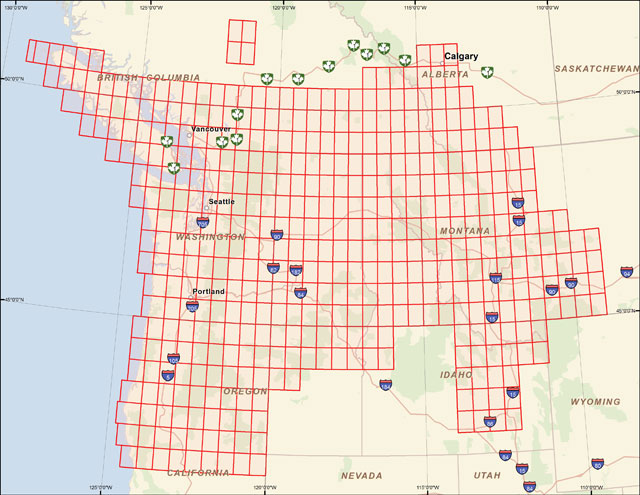
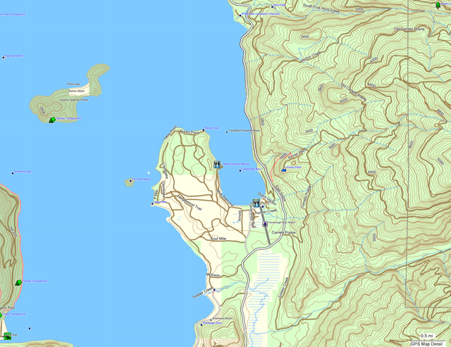
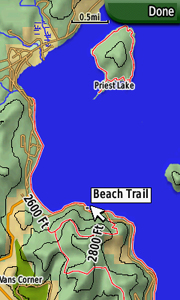 View Map Details/Download
Version 1.77 (April 26, 2013):
A transparent map offering trail coverage in the Northwest United States (Washington, Idaho, Oregon, Montana, Wyoming, and Alaska) as well as British Columbia and Alberta, Canada. It also includes the full length of the Pacific Crest Trail through California to the Mexico border. Custom types are used to help distinguish trail types: regular dirt trails, minor trails, paved trails, motorized/ATV trails, along with unpaved roads and paved roads that aid in navigation to trail sites.
Discussion related to this mapset can be found at the
Switchbacks.com Forum.
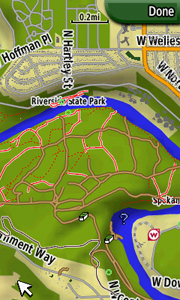
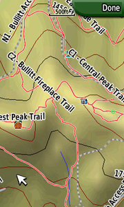 View Map Details/Download
This map is of the New York statewide Snowmobile Trails. It contains all GPS data of all the trail from the 2010-2011 season. This map is completely free of charge.
View Map Details/DownloadThis Transparent map will allow you to add a layer to your GPS showing the boundaries of Wildlife Management Units in Oregon. Use the map to see your position relative to WMU boundaries in the field or determine which GMU you are standing in. Turn this layer on and off as needed.
Now updated to 2018
View Map Details/DownloadWorld maps created from OpenStreetMaps data, designed for Garmin fenix watch. Version 10 released February 2016.
View Map Details/DownloadThis set has three maps. One for the Mark Twain Lake (MOGA), Marquette State Park, and Cahokia Mounds State Historic Site. These are maps you can use if you don’t have City Navigator. These are non-transparent maps that have roads, trails, topo lines, POIs, and water. In MapSource you can also use them to see everything at once.
View Map Details/DownloadPaiute OHV / ATV GPS map for trails in Utah and surrounding area including trails to/from Paiute to Bryce Canyon, Tropic Reservoir,Gooseberry, Circleville, and Arapeen.
View Map Details/DownloadGarmin Custom Map (raster image) including high resolution USGS 24k topo map from Terraserver. Only compatible with the Garmin Oregon, Dakota and Colorado series running the newest firmware
View Map Details/DownloadPercy Priest Lake; Nashville, TN; Contains 15 Channel Lines and 91 points of interest (mile markers, marinas, islands, rocks/shoals, boat ramps, etc.
View Map Details/DownloadThis is an ongoing project to capture all the trails at Philmont Scout Ranch outside Cimarron, NM especially as trails/camps/... change from year to year
View Map Details/DownloadCovers all of Iowa, Kansas, Missouri, Nebraska, and Oklahoma!
PRODUCT OVERVIEW:
An essential tool for your GPS, these fast, intuitive topo maps highlight all types of public lands. With this map you can easily determine your position in relation to public or private property boundaries, find new access, enjoy 24K topo, locate hunting unit boundaries, and we are just getting started! Endorsed by numerous State and Federal agencies, our maps are the most reliable source for land ownership maps on the market.
Map Key Features
Have the confidence in the field to be a better hunter and make ethical decisions. Our Maps have the same look and feel as standard BLM maps but with additional features:
- Color coded public and private lands
- 24K topographic functionality
- Section lines and numbers
- Roads (hwy, city, back-roads, trails)
- Water data (lakes, rivers, creeks, springs)
- National Forest roads and trails
- Geographic features and names
- Game Management or Hunting Units
- State specific features (WMA, WPA, CWMU)
onXmaps web page for Plains Regional Map
- Discover little-known, seldom-hunted public land.
- Navigate confidently around private lands you're not allowed to hunt.
- Easily identify big game hunting unit boundaries.
View Map Details/Download
Prentice Cooper WMA Trails v2.0, located approximately 8 miles West of Chattanooga, TN. Map has 75 miles of trails for OHV / ATV use and includes 95 POIs.
View Map Details/DownloadThis map is of the trails located in Prentice Cooper Wildlife Management Area close to Chattanooga, TN. The map is made up of (6) .kmz files. Map made from the paper map of Prentice Cooper WMA. This map will only work on Garmin GPSs that will recognize "Garmin Custom Maps".
View Map Details/DownloadHere is a map of the Quehanna Trail (Eastern Section). The trail is a 75-mile loop trail in the Moshannon and Elk State Forests of Pennsylvania. The Trail passes through some of the most wild and beautiful country Pennsylvania has to offer.
The mapps are broken up into two sections (Eastern and Western sections) and because of the large area each custom map set include between 42 and 48 tiles..
View Map Details/DownloadHere is a map of the Quehanna Trail (Western Section). The trail is a 75-mile loop trail in the Moshannon and Elk State Forests of Pennsylvania. The Trail passes through some of the most wild and beautiful country Pennsylvania has to offer.
The mapps are broken up into two sections (Eastern and Western sections) and because of the large area each custom map set include between 42 and 48 tiles.
View Map Details/DownloadTrail and road map for OHV trails in the Reno, Nevada area. Designed for OHV riders, specifically, those riding a side-by-side such as the RZR. Includes Hungry Valley, Antelope Valley Bedell Flat, Moon Rocks, and western Spanish Springs. 1381 trails, 281 square miles.
View Map Details/DownloadKMZ file using a map provided by the River to River Trail Society of the Shawnee National Forest. PDF versions of the Multi-day trail maps and trail guides are available at
https://www.rivertorivertrail.net/home/other-snf-info/shawnee-nf-multi-day-hikes/
The file was geo-tagged using Google Earth Pro and tiled using MKZFactory.
View Map Details/DownloadKMZ file using a map provided by the River to River Trail Society of the Shawnee National Forest. PDF versions of the Multi-day trail maps and trail guides are available at
https://www.rivertorivertrail.net/home/other-snf-info/shawnee-nf-multi-day-hikes/
The file was geotagged using Google Earth Pro and tiled using MKZFactory.
View Map Details/DownloadKMZ file using a map provided by the River to River Trail Society of the Shawnee National Forest. PDF versions of the Multi-day trail maps and trail guides are available at
https://www.rivertorivertrail.net/home/other-snf-info/shawnee-nf-multi-day-hikes/
The file was geo-tagged using Google Earth Pro and tiled using MKZFactory.
View Map Details/DownloadStart your adventure today! Suited for any outdoor activity, ROAM Rockies North for Garmin gives the detail you need when finding your next route. Comprised of the best 24k topo features on the market - Bringing together BLM, Forest Service, and Topographic data to provide a detailed map for all of your adventures. Here at onXmaps we strive to create the most detailed map of the Rockies North region ever available! Find new places to recreate using the most complete public lands and open spaces map. It's easy, just browse the map for color-coded lands and hit the trail. Our detailed public land data can expose City, County, State, Federal, or other open space lands that might hold your next favorite hiking, biking, ATVing, off-roading, or any other outdoor activity you wish to ROAM. Google Maps won't show you these secret spots! Bringing together topographic features for Montana, Idaho, and Wyoming - The ROAM Rockies North microSD Chip is a must have for any adventure!
View Map Details/DownloadStart your adventure today! Suited for any outdoor activity, ROAM Rockies South for Garmin gives the detail you need when finding your next route. Comprised of the best 24k topo features on the market - Bringing together BLM, Forest Service, and Topographic data to provide a detailed map for all of your adventures. Here at onXmaps we strive to create the most detailed map of the Rockies South region ever available! Find new places to recreate using the most complete public lands and open spaces map. It's easy, just browse the map for color-coded lands and hit the trail. Our detailed public land data can expose City, County, State, Federal, or other open space lands that might hold your next favorite hiking, biking, ATVing, off-roading, or any other outdoor activity you wish to ROAM. Google Maps won't show you these secret spots! Bringing together topographic features for Colorado, Utah, New Mexico, Arizona - The ROAM Rockies South microSD Chip is a must have for any adventure!
View Map Details/DownloadPRODUCT OVERVIEW:
An essential tool for your GPS, these fast, intuitive topo maps highlight all types of public lands. With this map you can easily determine your position in relation to public or private property boundaries, find new access, enjoy 24K topo, locate hunting unit boundaries, and we are just getting started! Endorsed by numerous State and Federal agencies, our maps are the most reliable source for land ownership maps on the market.
Map Key Features
Have the confidence in the field to be a better hunter and make ethical decisions. Our Maps have the same look and feel as standard BLM maps but with additional features:
- Color coded public and private lands
- 24K topographic functionality
- Section lines and numbers
- Roads (hwy, city, back-roads, trails)
- Water data (lakes, rivers, creeks, springs)
- National Forest roads and trails
- Geographic features and names
- Game Management or Hunting Units
- State specific features (WMA, WPA, CWMU)
onXmaps web page for Hunt Rockies North Regional Map
- Discover little-known, seldom-hunted public land.
- Navigate confidently around private lands you're not allowed to hunt.
- Easily identify big game hunting unit boundaries.
View Map Details/Download
PRODUCT OVERVIEW:
An essential tool for your GPS, these fast, intuitive topo maps highlight all types of public lands. With this map you can easily determine your position in relation to public or private property boundaries, find new access, enjoy 24K topo, locate hunting unit boundaries, and we are just getting started! Endorsed by numerous State and Federal agencies, our maps are the most reliable source for land ownership maps on the market.
Map Key Features
Have the confidence in the field to be a better hunter and make ethical decisions. Our Maps have the same look and feel as standard BLM maps but with additional features:
- Color coded public and private lands
- 24K topographic functionality
- Section lines and numbers
- Roads (hwy, city, back-roads, trails)
- Water data (lakes, rivers, creeks, springs)
- National Forest roads and trails
- Geographic features and names
- Game Management or Hunting Units
- State specific features (WMA, WPA, CWMU)
onXmaps web page for Hunt Rockies South Regional Map
- Discover little-known, seldom-hunted public land.
- Navigate confidently around private lands you're not allowed to hunt.
- Easily identify big game hunting unit boundaries.
View Map Details/Download
1:24000 raster topo map of the Sierra Nevada primarily of interest to hikers and backpackers. Created by John Hollenberg with Moagu and data downloaded from scanned topos from the USGS seamless server.
The area covered extends from the Golden Trout Wilderness in the South to Yosemite and the Emigrant Wilderness in the North. The map is comprised of 120 7.5 minute quads and covers over 6,000 square miles.
View Map Details/DownloadA detailed map of Sleepy Hollow State Park. Including trails, roads, points of interest, etc. This map type is for use with the Garmin Oregon, Dakota and Colorado models. This is my first map and it has not been tested. I welcome any feedback. Thank you.
View Map Details/DownloadSouth Central United States
Last Updated: January 31th, 2009 16:00pm
Map Boundary:
North: 37°
South: 25.5°
West: -109°
East: -093°
Country: United States
States: All of New Mexico, Oklahoma, and Texas
Parts of Arkansas, Louisiana, and Missouri
Price: Free
Map Features:
Topographic Data
Street Data
No Installer
* Roads - Interstates, highways, arterial roads, residential roads, limited unpaved roads
* Railroads
* High resolution water data - lakes, rivers, streams, and washes
* Federal Land Usage - Wilderness area, national parks, and military bases/ranges, native american reservations
* Borders - County and state boundary lines
* Elevation contours - 20ft intervals
* GNIS Points of Interest - summits, mines, falls, dams, cemeteries, towers, populated places, etc.
* 4 Grid Segments to the dergee - no segment larger than 5.2mb most less then 3mb in size
View Map Details/Download-
-
-
-
-
-
-
-
-
-
-
-
-
For Garmin Units, Lowrance Units, Magellan & now iPhone/iPad/iPod Touch Units.
Please read all instructions before use.
View Map Details/DownloadThis map was created by John M.
-It contains 20ft contours for south east united states.
-Detailed high quality water data
-Detailed road maps
View Map Details/DownloadPRODUCT OVERVIEW:
An essential tool for your GPS, these fast, intuitive topo maps highlight all types of public lands. With this map you can easily determine your position in relation to public or private property boundaries, find new access, enjoy 24K topo, locate hunting unit boundaries, and we are just getting started! Endorsed by numerous State and Federal agencies, our maps are the most reliable source for land ownership maps on the market.
Map Key Features
Have the confidence in the field to be a better hunter and make ethical decisions. Our Maps have the same look and feel as standard BLM maps but with additional features:
- Color coded public and private lands
- 24K topographic functionality
- Section lines and numbers
- Roads (hwy, city, back-roads, trails)
- Water data (lakes, rivers, creeks, springs)
- National Forest roads and trails
- Geographic features and names
- Game Management or Hunting Units
- State specific features (WMA, WPA, CWMU)
Hunting GPS Maps web page for HUNT South Regional Map
- Discover little-known, seldom-hunted public land.
- Navigate confidently around private lands you're not allowed to hunt.
- Easily identify big game hunting unit boundaries.
View Map Details/Download
* Roads - Interstates, highways, arterial roads, residential roads, limited unpaved roads
* Railroads
* High resolution water data - lakes, rivers, streams, and washes
* Federal Land Usage - Wilderness area, national parks, and military bases/ranges, native american reservations
* Borders - County and state boundary lines
* Elevation contours - 20ft intervals
* GNIS Points of Interest - summits, mines, falls, dams, cemeteries, towers, populated places, etc.
* 4 Grid Segments to the dergee - no segment larger than 7.8mb most less then 3mb in size
View Map Details/DownloadTopo and hydrography from USGS, vectorized wooded areas from USGS, place names from GNIS. 24K detail, 40 foot contours. NO ROADS, TRAILS, OR BOUNDARIES.
This map is meant to serve as an overlay for a routable map like City Navigator NANT. Includes Arches, Canyonlands, Capitol Reef, Bryce Canyon, Zion, and Cedar Breaks.
View Map Details/DownloadSouthwest Trails is a free transparent map overlay for Garmin GPS receivers featuring trails in Arizona and New Mexico. Versions available for both Windows and Mac. Current version is v0.60 (11/29/2010).
View Map Details/DownloadGot Trails?
The Southwest Trails map project is a collection of trail data from six southwest USA states (Arizona, California, Colorado, Nevada, New Mexico and Utah) compiled for use with compatible Garmin GPS receivers. Southwest Trails is a transparent map, and may be used as a primary map (no additional maps enabled - only trail data will be visible) or as an overlay map (additional maps enabled - trail data layered above visible maps).
16DEC13 v1.3.7 New Version Update (37,025 trail miles)
25NOV13 Added Custom TYP File Options
27OCT13 v1.3.3 New Version Update (34,896 trail miles)
22OCT13 v1.3.2 New Version Update (19,570 trail miles)
17OCT13 v1.3.1 Initial Release (16,240 trail miles)
View Map Details/DownloadGarmin aerial imagery for Spring Meadow Lake State Park in Helena Montana. Helena High Resolution Imagery - 2008
View Map Details/Download****Up Dated 2014 Version****
I have updated my Taylor Park Trails Map for and upcoming trip. All trails are now very accurate via various satellite imagery. Added several new trails.
Trails are difficulty color coded per Charles Wells Book and Latitude 40 map. It only shows legal ATV Trails per the latest Gunnison North MVUM.
Download also included links to get Charles Wells book, Latitude 40 map, and MVUM.
View Map Details/DownloadTaylor Park, CO ATV Trails. Located approximately 30 miles Northeast of Gunnison, CO at Taylor Park Reservoir. Map contains 214 POIs. Trails are color coded by trail difficulty.
View Map Details/DownloadSorry, boydsmaps no longer offers Garmin-format maps for download. However you can access this map (and over 200 others) in the free boydsmaps web app. There's no advertising and no registration, just use the link below to access this map on your computer or phone. See the help function for full documentation of all the other app features.
View Map Details/DownloadGarmin Custom Maps (raster images) including high resolution USGS 24k topo map and NJ 2007 orthophotography. Only compatible with the Garmin Oregon, Dakota and Colorado series running the newest firmware.
View Map Details/DownloadRoad map of USA created from OpenStreetMap data.
This is experimental map. It is a result of an attempt to create a map for Garmin with reasonable routing on long distances. Map size is about 3GB.
View Map Details/DownloadDetailed map of USA for Garmin GPS, based on OpenStreetMap data. Full map is about 9GB, it can be downloaded as a whole mapset or smaller regions. Maps can be installed under Windows or Mac OSX.
SRTM contour lines 25m, NOAA depth contours, USGS Landcover Woodlands.
View Map Details/DownloadMap of all the states and counties in the United States. This is a transparent map meant to overlay other maps.
View Map Details/DownloadTopo Map for Maine, New Hampshire, Vermont, Massachusetts, Rhode Island, Connecticut, New York, Pennsylvania, New Jersey and Deleware
View Map Details/DownloadTopo Map of Florida, Mississippi, Alabama, Georgia, Tennessee, Kentucky, North Carolina, South Carolina, Virginia, West Virginia and Maryland
View Map Details/DownloadThis zip file contains a shapefile of building footprint polygons for the entire United States and parts of Puerto Rico.
View Map Details/Download### Map updated on 1/7/23 to add full coverage of Ohio plus expanded coverage of Indiana, Kentucky and Michigan (1764 new quadrangles). ###
The United States Geological Survey began creating 24k topographic maps in the 1940's and completed the series in 1992 with revisions continuing through 2006. Starting in 2009, the USGS began replacing these legacy maps with their new digital "US Topo" series which have less detail. In discontinuing the legacy maps, the USGS explained:
"Traditional national mapping programs gathered data from primary sources, including direct field observation. Such maps were compiled, drawn, and edited by hand. In the United States, the era of traditional topographic mapping lasted from about 1880 to about 1990, and was primarily the responsibility of the U.S. Geological Survey (USGS). By today's standards these traditional methods were very expensive, and USGS no longer has either mission or funding to make maps this way."
In spite of their age, many people still consider these to be the "gold standard" of topographic mapping due to their rich detail and a sense of style that is missing from the digital US Topo series.
This map is an all-new curated collection of 7,438 USGS 7.5 Minute quadrangles (about 13 million map tiles) from the USGS Historical Topographic Map Collection and is not available anywhere else. It includes full coverage of Connecticut, Delaware, Maine, Maryland, Massachussets, New Hampshire, New Jersey, New York, Ohio, Pennsylvania, Rhode Island, Vermont, Virginia and West Virginia with partial coverage of Indiana, Kentucky, Tennessee and Michigan. (This is an ongoing project and coverage will continue to expand in the future.)
The newest version of each quad was used unless there were quality issues. About half of the quadrangles are from the period 1950-1969 and another third date from 1980-1999. No legacy maps were available for about 100 quadrangles, so the new digital US Topo maps were used for these.
As you zoom out, the view switches to a mosaic of 275 USGS 100k topo maps and then to a group of 88 USGS 250k maps as you zoom farther. At smaller scales, the USGS National Map Topo Basemap is shown.
Original .tif files were downloaded from the Historical Topographic Map Collection, cropped to remove the collar and re-projected as Web Mercator. These source files were processed at a resolution of 2.4 meters/pixel which preserves the full detail of the original USGS 300 dot-per-inch scans. Do not confuse this map with 24k topos on other sites that are typically based on either the ArcGIS 24k topo or old USGS DRG files.
The ArcGIS topo is actually the old National Geographic "TOPO!" product, with noticeable image compression artifacts and only half the resolution of the boydsmaps legacy topo. Hillshading was also added to these maps by National Geographic, fundamentally changing their appearance.
The other common version of the 24k topo maps is based on USGS DRG (DIgital Raster Graphic) files. These date from the time when online imagery needed to be highly-compressed for storage and delivery. Unfortunately quality suffered as a result, with severe image compression artifacts and too much contrast.
Garmin devices do not offer any serious support for raster imagery, so this map is only available in the free boydsmaps web app. Garmin's "custom maps" raster format only supports a total of 100 tiles at 1024x1024 on most devices, however this map would contain about 800,000 tiles if processed in that format!
The boydsmaps web app is compatible with all devices and operating systems, it's free, there's no advertising and no registration. Use it on your phone like a handheld GPS or on your computer with an interface designed for large screens. It's a website, but can also be installed as an app which offers many advantages, especially on phones. There are over 200 maps, covering the entire world, including the full suite of maps from HERE and Mapbox. Many other features like waypoints, elevation data, weather, radar and more. See the built-in help function for full documentation.
There's nothing to download, just click the link below and start using the map right away!
View Map Details/Download### Map updated on 1/18/23 to add full coverage of Ohio plus expanded coverage of Indiana, Kentucky and Michigan (465 new quadrangles). ###
The US Geological Survey has been the primary agency responsible for mapping the United States since 1879 and this new curated collection includes almost two thousand of the oldest topo maps available from the USGS archives. These old maps were drawn at the scale of 1:62,500 with a coverage of 15 minutes (1/4 degree). Almost two thirds of the quadrangles in the map are 100 or more years old.
The map includes full coverage of Connecticut, Delaware, Maine, Maryland, Massachussets, New Hampshire, New Jersey, New York, Ohio, Pennsylvania, Rhode Island, Vermont, Virginia and West Virginia with partial coverage of Kentucky, Indiana and Michigan. (This is an ongoing project and coverage will continue to expand in the future)
Original .tif files were downloaded from the Historical Topographic Map Collection, cropped to remove the collar and re-projected as Web Mercator. These source files were processed at a resolution of 4.8 meters/pixel which preserves the full detail of the original USGS 300 dot-per-inch scans.
As you zoom out, the view switches to 86 of the oldest available USGS 250k maps (mostly from the 1950's). At smaller scales, the contemporary (digital) USGS National Map Topo Basemap is shown
Garmin devices do not offer any serious support for raster imagery, so this map is only available in the free boydsmaps web app. Garmin's "custom maps" (.kmz) raster format only supports a total of 100 tiles at 1024x1024 on most devices, however this map would contain over 250,000 tiles if processed in that format!
The boydsmaps web app is compatible with all devices and operating systems, it's free, there's no advertising and no registration. Use it on your phone like a handheld GPS or on your computer with an interface designed for large screens. It's a website, but can also be installed as an app which offers many advantages, especially on phones. There are over 200 maps, covering the entire world, including the full suite of maps from HERE and Mapbox. Many other features like waypoints, elevation data and more. See the built-in help function for full documentation.
There's nothing to download, just click the link below and start using the map right away!
View Map Details/Download******** Paiute ATV Trails 2013 ********
This is a very accurate map of the Paiute ATV Trails along with some of the more popular trails that are encompassed by the Paiute Trail System.
A lot of these trails were recently ridden and tracked. These tracks were cleaned up using Google Earth. The trails are numbered per the latest National Geographic #708 map. There are no longer any duplicate trail numbers. Gary Bushman (aka: ATVUTAH.com) helped with some of the trail updating and accuracy.
The map includes accurate locations of the gas stations and restuarants in the cities that are within the Paiute Trail System. The restrooms along the trail system have also been accurately located.
When installing the map you will have the choice to install the original map gps tracks onto your computer. This is useful if you want to view the tracks in Google Earth.
When installing please read the color coding scheme.
View Map Details/DownloadThis transparent map will allow you to add a layer to your GPS showing the boundaries of Bear Hunt Units in Utah. Use the map to see your position relative to Bear Hunt Unit boundaries in the field or determine which hunt unit you are standing in. Turn this layer on and off as needed. Use this transparent map in conjunction with other map products.
Updated in 2018
View Map Details/DownloadThis transparent map will allow you to add a layer to your GPS showing the boundaries of Bison Hunt Units in Wyoming. Use the map to see your position relative to Bison Hunt Unit boundaries in the field or determine which hunt unit you are standing in. Turn this layer on and off as needed. Use this transparent map in conjunction with other map products.
Updated in 2018
View Map Details/DownloadThis transparent map will allow you to add a layer to your GPS showing the boundaries of Bull Elk Hunt Units in Utah. Use the map to see your position relative to Bull Elk Hunt Unit boundaries in the field or determine which hunt area you are standing in. Turn this layer on and off as needed. Use this transparent map in conjunction with other map products.
Updated in 2018
View Map Details/DownloadA topo map of the entire state of Utah including roads, high resolution water data, contours (40ft), land uses, and points of interest. Equivalent to a 24k topo.
View Map Details/DownloadThis transparent map will allow you to add a layer to your GPS showing the boundaries of Turkey Hunt Units in Utah. Use the map to see your position relative to Turkey Hunt Unit boundaries in the field or determine which hunt unit you are standing in. Turn this layer on and off as needed. Use this transparent map in conjunction with other map products.
Updated in 2018
View Map Details/Download
-
-
-
-
-
-
-
-
-
-
-
-
-
This Transparent map will allow you to add a layer to your GPS showing the boundaries of Big Game Wildlife Management Units in Utah. Use the map to see your position relative to Wildlife Management Unit boundaries in the field or determine which GMU you are standing in. Turn this layer on and off as needed.
Now updated to 2018
View Map Details/DownloadWashington Topo Map with 40ft contours. Enjoy! and yeah, contribute back. Features high quality water data, road data, federal lands etc. Available for Mac & PC
View Map Details/DownloadThis Transparent map will allow you to add a layer to your GPS showing the boundaries of Big Game Management Units in Washington. Use the map to see your position relative to GMU boundaries in the field or determine which GMU you are standing in. Turn this layer on and off as needed.
View Map Details/DownloadA detailed map of snowmobile trails throughout Washington. The trails are broken into groomed and ungroomed when shown on your GPSr screen. There are two versions available: a transparent trails-only version and a version with lakes, rivers, and roads in addition to the trails.
View Map Details/DownloadWashington Map Features: 40-Foot Contours, High Resolution Water Data, 15-minute Map Segments, Federal Land Areas, Points of Interest, Forest Service Trails, BTS + Last Mile Roads, Free Trial Download
View Map Details/DownloadColorado Map Features: 40-Foot Contours, High Resolution Water Data, 15-minute Coverage per Map, Extensive Geologic Feature Points, Forest Service Trails, BTS Roads, Covers ALL of Colorado's Mountains, Free Trial Download.
View Map Details/DownloadGarmin Custom Map of the Wharton State Forest, New Jersey featuring USGS 24k topo raster imagery. This map is only compatible with the Oregon, Colorado and Dakota series running the newest firmware.
View Map Details/DownloadNew Jersey 1995 DOQQ Orthoimagery covering most of the Wharton State Forest in Southern New Jersey. Garmin Custom (.kmz raster) map compatible only with newer model handheld units.
View Map Details/DownloadWilderness Trail Off-Road Park, near Middlesboro, KY(60 miles N. of Knoxville, TN). ATV riding area encompasses 9,000 acres with 120 miles of trails. This map can only be installed on Garmin GPSs that are capable of using Garmin Custom Maps.
View Map Details/DownloadWilderness Trail OHV / ATV Park GPS map, near Middlesboro, KY (60 miles N. of Knoxville, TN). ATV riding area encompasses 9,000 acres with 120 miles of trails.
View Map Details/DownloadWindrock OHV / ATV Trails at Oliver Springs, TN near Oak Ridge. 72,000 acres with more than 160 miles of trails. The Windrock / Coal Creek OHV Trails are also included in my North Cumberland Trails Map which is the map that should be used now, it is kept more up to date. This map, Windrock / Coal Creek is no longer supported.
View Map Details/DownloadA detailed map of snowmobile trails in Wisconsin. This map is made of user-contributed data as well as trail data available from the state. The complete version includes roads, trails, rivers, and lakes while the transparent trails only version is designed to overlay any other maps you may have installed. Links very well to the
Michigan Snowmobile Map.
View Map Details/Downloadscheme�?????????????????????????????????????????????�????????????????????????????????????????????�??????????????????????????????????????????�?????????????????????????????????????????�????????????????????????????????????????�???????????????????????????????????????�??????????????????????????????????????�?????????????????????????????????????�????????????????????????????????????�???????????????????????????????????�??????????????????????????????????�?????????????????????????????????�????????????????????????????????�???????????????????????????????�??????????????????????????????�?????????????????????????????�????????????????????????????�???????????????????????????�??????????????????????????�?????????????????????????�????????????????????????�???????????????????????�??????????????????????�?????????????????????�????????????????????�???????????????????�??????????????????�?????????????????�????????????????�???????????????�??????????????�?????????????�????????????�???????????�??????????�?????????�????????�???????�??????�?????�????�???�??�?�¢??�?????????????????????????????????????????????�????????????????????????????????????????????�???????????????????????????????????????????�??????????????????????????????????????????�?????????????????????????????????????????�????????????????????????????????????????�???????????????????????????????????????�??????????????????????????????????????�?????????????????????????????????????�????????????????????????????????????�???????????????????????????????????�??????????????????????????????????�?????????????????????????????????�????????????????????????????????�???????????????????????????????�??????????????????????????????�?????????????????????????????�????????????????????????????�???????????????????????????�??????????????????????????�?????????????????????????�????????????????????????�???????????????????????�??????????????????????�?????????????????????�????????????????????�???????????????????�??????????????????�?????????????????�????????????????�???????????????�??????????????�?????????????�????????????�???????????�??????????�?????????�????????�???????�??????�?????�????�???�??�?�¿�?????????????????????????????????????????????�?????????????????????????????????????????????�?????????????????????????????????????????????�?????????????????????????????????????????????�????????????????????????????????????????????�???????????????????????????????????????????�??????????????????????????????????????????�?????????????????????????????????????????�????????????????????????????????????????�???????????????????????????????????????�??????????????????????????????????????�?????????????????????????????????????�????????????????????????????????????�???????????????????????????????????�??????????????????????????????????�?????????????????????????????????�????????????????????????????????�???????????????????????????????�??????????????????????????????�?????????????????????????????�????????????????????????????�???????????????????????????�??????????????????????????�?????????????????????????�????????????????????????�???????????????????????�??????????????????????�?????????????????????�????????????????????�???????????????????�??????????????????�?????????????????�????????????????�???????????????�??????????????�?????????????�????????????�???????????�??????????�?????????�????????�???????�??????�?????�????�???�??�?�¿�?????????????????????????????????????????????�????????????????????????????????????????????�???????????????????????????????????????????�??????????????????????????????????????????�?????????????????????????????????????????�????????????????????????????????????????�???????????????????????????????????????�??????????????????????????????????????�?????????????????????????????????????�????????????????????????????????????�???????????????????????????????????�??????????????????????????????????�?????????????????????????????????�????????????????????????????????�???????????????????????????????�??????????????????????????????�?????????????????????????????�????????????????????????????�???????????????????????????�??????????????????????????�?????????????????????????�????????????????????????�???????????????????????�??????????????????????�?????????????????????�????????????????????�???????????????????�??????????????????�?????????????????�????????????????�???????????????�??????????????�?????????????�????????????�???????????�??????????�?????????�????????�???????�??????�?????�????�???�??�?�¿�?????????????????????????????????????????????�?????????????????????????????????????????????�????????????????????????????????????????????�??????????????????????????????????????????�?????????????????????????????????????????�????????????????????????????????????????�???????????????????????????????????????�??????????????????????????????????????�?????????????????????????????????????�????????????????????????????????????�???????????????????????????????????�??????????????????????????????????�?????????????????????????????????�????????????????????????????????�???????????????????????????????�??????????????????????????????�?????????????????????????????�????????????????????????????�???????????????????????????�??????????????????????????�?????????????????????????�????????????????????????�???????????????????????�??????????????????????�?????????????????????�????????????????????�???????????????????�??????????????????�?????????????????�????????????????�???????????????�??????????????�?????????????�????????????�???????????�??????????�?????????�????????�???????�??????�?????�????�???�??�?�¢??�?????????????????????????????????????????????�????????????????????????????????????????????�???????????????????????????????????????????�??????????????????????????????????????????�?????????????????????????????????????????�????????????????????????????????????????�???????????????????????????????????????�??????????????????????????????????????�?????????????????????????????????????�????????????????????????????????????�???????????????????????????????????�??????????????????????????????????�?????????????????????????????????�????????????????????????????????�???????????????????????????????�??????????????????????????????�?????????????????????????????�????????????????????????????�???????????????????????????�??????????????????????????�?????????????????????????�????????????????????????�???????????????????????�??????????????????????�?????????????????????�????????????????????�???????????????????�??????????????????�?????????????????�????????????????�???????????????�??????????????�?????????????�????????????�???????????�??????????�?????????�????????�???????�??????�?????�????�???�??�?�¿�?????????????????????????????????????????????�?????????????????????????????????????????????�???????????????????????????????????????????�??????????????????????????????????????????�?????????????????????????????????????????�????????????????????????????????????????�???????????????????????????????????????�??????????????????????????????????????�?????????????????????????????????????�????????????????????????????????????�???????????????????????????????????�??????????????????????????????????�?????????????????????????????????�????????????????????????????????�???????????????????????????????�??????????????????????????????�?????????????????????????????�????????????????????????????�???????????????????????????�??????????????????????????�?????????????????????????�????????????????????????�???????????????????????�??????????????????????�?????????????????????�????????????????????�???????????????????�??????????????????�?????????????????�????????????????�???????????????�??????????????�?????????????�????????????�???????????�??????????�?????????�????????�???????�??????�?????�????�???�??�?�¢??�?????????????????????????????????????????????�????????????????????????????????????????????�???????????????????????????????????????????�??????????????????????????????????????????�?????????????????????????????????????????�????????????????????????????????????????�???????????????????????????????????????�??????????????????????????????????????�?????????????????????????????????????�????????????????????????????????????�???????????????????????????????????�??????????????????????????????????�?????????????????????????????????�????????????????????????????????�???????????????????????????????�??????????????????????????????�?????????????????????????????�????????????????????????????�???????????????????????????�??????????????????????????�?????????????????????????�????????????????????????�???????????????????????�??????????????????????�?????????????????????�????????????????????�???????????????????�??????????????????�?????????????????�????????????????�???????????????�??????????????�?????????????�????????????�???????????�??????????�?????????�????????�???????�??????�?????�????�???�??�?�¿�?????????????????????????????????????????????�?????????????????????????????????????????????�?????????????????????????????????????????????�????????????????????????????????????????????�???????????????????????????????????????????�??????????????????????????????????????????�?????????????????????????????????????????�????????????????????????????????????????�???????????????????????????????????????�??????????????????????????????????????�?????????????????????????????????????�????????????????????????????????????�???????????????????????????????????�??????????????????????????????????�?????????????????????????????????�????????????????????????????????�???????????????????????????????�??????????????????????????????�?????????????????????????????�????????????????????????????�???????????????????????????�??????????????????????????�?????????????????????????�????????????????????????�???????????????????????�??????????????????????�?????????????????????�????????????????????�???????????????????�??????????????????�?????????????????�????????????????�???????????????�??????????????�?????????????�????????????�???????????�??????????�?????????�????????�???????�??????�?????�????�???�??�?�¿�?????????????????????????????????????????????�????????????????????????????????????????????�???????????????????????????????????????????�??????????????????????????????????????????�?????????????????????????????????????????�????????????????????????????????????????�???????????????????????????????????????�??????????????????????????????????????�?????????????????????????????????????�????????????????????????????????????�???????????????????????????????????�??????????????????????????????????�?????????????????????????????????�????????????????????????????????�???????????????????????????????�??????????????????????????????�?????????????????????????????�????????????????????????????�???????????????????????????�??????????????????????????�?????????????????????????�????????????????????????�???????????????????????�??????????????????????�?????????????????????�????????????????????�???????????????????�??????????????????�?????????????????�????????????????�???????????????�??????????????�?????????????�????????????�???????????�??????????�?????????�????????�???????�??????�?????�????�???�??�?�¿�?????????????????????????????????????????????�?????????????????????????????????????????????�????????????????????????????????????????????�??????????????????????????????????????????�?????????????????????????????????????????�????????????????????????????????????????�???????????????????????????????????????�??????????????????????????????????????�?????????????????????????????????????�????????????????????????????????????�???????????????????????????????????�??????????????????????????????????�?????????????????????????????????�????????????????????????????????�???????????????????????????????�??????????????????????????????�?????????????????????????????�????????????????????????????�???????????????????????????�??????????????????????????�?????????????????????????�????????????????????????�???????????????????????�??????????????????????�?????????????????????�????????????????????�???????????????????�??????????????????�?????????????????�????????????????�???????????????�??????????????�?????????????�????????????�???????????�??????????�?????????�????????�???????�??????�?????�????�???�??�?�¢??�?????????????????????????????????????????????�????????????????????????????????????????????�???????????????????????????????????????????�??????????????????????????????????????????�?????????????????????????????????????????�????????????????????????????????????????�???????????????????????????????????????�??????????????????????????????????????�?????????????????????????????????????�????????????????????????????????????�???????????????????????????????????�??????????????????????????????????�?????????????????????????????????�????????????????????????????????�???????????????????????????????�??????????????????????????????�?????????????????????????????�????????????????????????????�???????????????????????????�??????????????????????????�?????????????????????????�????????????????????????�???????????????????????�??????????????????????�?????????????????????�????????????????????�???????????????????�??????????????????�?????????????????�????????????????�???????????????�??????????????�?????????????�????????????�???????????�??????????�?????????�????????�???????�??????�?????�????�???�??�?�¿�?????????????????????????????????????????????�?????????????????????????????????????????????�?????????????????????????????????????????????�?????????????????????????????????????????????�????????????????????????????????????????????�???????????????????????????????????????????�??????????????????????????????????????????�?????????????????????????????????????????�????????????????????????????????????????�???????????????????????????????????????�??????????????????????????????????????�?????????????????????????????????????�????????????????????????????????????�???????????????????????????????????�??????????????????????????????????�?????????????????????????????????�????????????????????????????????�???????????????????????????????�??????????????????????????????�?????????????????????????????�????????????????????????????�???????????????????????????�??????????????????????????�?????????????????????????�????????????????????????�???????????????????????�??????????????????????�?????????????????????�????????????????????�???????????????????�??????????????????�?????????????????�????????????????�???????????????�??????????????�?????????????�????????????�???????????�??????????�?????????�????????�???????�??????�?????�????�???�??�?�¿�?????????????????????????????????????????????�????????????????????????????????????????????�???????????????????????????????????????????�??????????????????????????????????????????�?????????????????????????????????????????�????????????????????????????????????????�???????????????????????????????????????�??????????????????????????????????????�?????????????????????????????????????�????????????????????????????????????�???????????????????????????????????�??????????????????????????????????�?????????????????????????????????�????????????????????????????????�???????????????????????????????�??????????????????????????????�?????????????????????????????�????????????????????????????�???????????????????????????�??????????????????????????�?????????????????????????�????????????????????????�???????????????????????�??????????????????????�?????????????????????�????????????????????�???????????????????�??????????????????�?????????????????�????????????????�???????????????�??????????????�?????????????�????????????�???????????�??????????�?????????�????????�???????�??????�?????�????�???�??�?�¿�?????????????????????????????????????????????�?????????????????????????????????????????????�????????????????????????????????????????????�??????????????????????????????????????????�?????????????????????????????????????????�????????????????????????????????????????�???????????????????????????????????????�??????????????????????????????????????�?????????????????????????????????????�????????????????????????????????????�???????????????????????????????????�??????????????????????????????????�?????????????????????????????????�????????????????????????????????�???????????????????????????????�??????????????????????????????�?????????????????????????????�????????????????????????????�???????????????????????????�??????????????????????????�?????????????????????????�????????????????????????�???????????????????????�??????????????????????�?????????????????????�????????????????????�???????????????????�??????????????????�?????????????????�????????????????�???????????????�??????????????�?????????????�????????????�???????????�??????????�?????????�????????�???????�??????�?????�????�???�??�?�¢??�?????????????????????????????????????????????�????????????????????????????????????????????�???????????????????????????????????????????�??????????????????????????????????????????�?????????????????????????????????????????�????????????????????????????????????????�???????????????????????????????????????�??????????????????????????????????????�?????????????????????????????????????�????????????????????????????????????�???????????????????????????????????�??????????????????????????????????�?????????????????????????????????�????????????????????????????????�???????????????????????????????�??????????????????????????????�?????????????????????????????�????????????????????????????�???????????????????????????�??????????????????????????�?????????????????????????�????????????????????????�???????????????????????�??????????????????????�?????????????????????�????????????????????�???????????????????�??????????????????�?????????????????�????????????????�???????????????�??????????????�?????????????�????????????�???????????�??????????�?????????�????????�???????�??????�?????�????�???�??�?�¿�?????????????????????????????????????????????�?????????????????????????????????????????????�???????????????????????????????????????????�??????????????????????????????????????????�?????????????????????????????????????????�????????????????????????????????????????�???????????????????????????????????????�??????????????????????????????????????�?????????????????????????????????????�????????????????????????????????????�???????????????????????????????????�??????????????????????????????????�?????????????????????????????????�????????????????????????????????�???????????????????????????????�??????????????????????????????�?????????????????????????????�????????????????????????????�???????????????????????????�??????????????????????????�?????????????????????????�????????????????????????�???????????????????????�??????????????????????�?????????????????????�????????????????????�???????????????????�??????????????????�?????????????????�????????????????�???????????????�??????????????�?????????????�????????????�???????????�??????????�?????????�????????�???????�??????�?????�????�???�??�?�¢??�?????????????????????????????????????????????�????????????????????????????????????????????�???????????????????????????????????????????�??????????????????????????????????????????�?????????????????????????????????????????�????????????????????????????????????????�???????????????????????????????????????�??????????????????????????????????????�?????????????????????????????????????�????????????????????????????????????�???????????????????????????????????�??????????????????????????????????�?????????????????????????????????�????????????????????????????????�???????????????????????????????�??????????????????????????????�?????????????????????????????�????????????????????????????�???????????????????????????�??????????????????????????�?????????????????????????�????????????????????????�???????????????????????�??????????????????????�?????????????????????�????????????????????�???????????????????�??????????????????�?????????????????�????????????????�???????????????�??????????????�?????????????�????????????�???????????�??????????�?????????�????????�???????�??????�?????�????�???�??�?�¿�?????????????????????????????????????????????�????????????????????????????????????????????�??????????????????????????????????????????�?????????????????????????????????????????�????????????????????????????????????????�???????????????????????????????????????�??????????????????????????????????????�?????????????????????????????????????�????????????????????????????????????�???????????????????????????????????�??????????????????????????????????�?????????????????????????????????�????????????????????????????????�???????????????????????????????�??????????????????????????????�?????????????????????????????�????????????????????????????�???????????????????????????�??????????????????????????�?????????????????????????�????????????????????????�???????????????????????�??????????????????????�?????????????????????�????????????????????�???????????????????�??????????????????�?????????????????�????????????????�???????????????�??????????????�?????????????�????????????�???????????�??????????�?????????�????????�???????�??????�?????�????�???�??�?�¢??�?????????????????????????????????????????????�????????????????????????????????????????????�???????????????????????????????????????????�??????????????????????????????????????????�?????????????????????????????????????????�????????????????????????????????????????�???????????????????????????????????????�??????????????????????????????????????�?????????????????????????????????????�????????????????????????????????????�???????????????????????????????????�??????????????????????????????????�?????????????????????????????????�????????????????????????????????�???????????????????????????????�??????????????????????????????�?????????????????????????????�????????????????????????????�???????????????????????????�??????????????????????????�?????????????????????????�????????????????????????�???????????????????????�??????????????????????�?????????????????????�????????????????????�???????????????????�??????????????????�?????????????????�????????????????�???????????????�??????????????�?????????????�????????????�???????????�??????????�?????????�????????�???????�??????�?????�????�???�??�?�¿�?????????????????????????????????????????????�?????????????????????????????????????????????�???????????????????????????????????????????�??????????????????????????????????????????�?????????????????????????????????????????�????????????????????????????????????????�???????????????????????????????????????�??????????????????????????????????????�?????????????????????????????????????�????????????????????????????????????�???????????????????????????????????�??????????????????????????????????�?????????????????????????????????�????????????????????????????????�???????????????????????????????�??????????????????????????????�?????????????????????????????�????????????????????????????�???????????????????????????�??????????????????????????�?????????????????????????�????????????????????????�???????????????????????�??????????????????????�?????????????????????�????????????????????�???????????????????�??????????????????�?????????????????�????????????????�???????????????�??????????????�?????????????�????????????�???????????�??????????�?????????�????????�???????�??????�?????�????�???�??�?�¢??�?????????????????????????????????????????????�????????????????????????????????????????????�???????????????????????????????????????????�??????????????????????????????????????????�?????????????????????????????????????????�????????????????????????????????????????�???????????????????????????????????????�??????????????????????????????????????�?????????????????????????????????????�????????????????????????????????????�???????????????????????????????????�??????????????????????????????????�?????????????????????????????????�????????????????????????????????�???????????????????????????????�??????????????????????????????�?????????????????????????????�????????????????????????????�???????????????????????????�??????????????????????????�?????????????????????????�????????????????????????�???????????????????????�??????????????????????�?????????????????????�????????????????????�???????????????????�??????????????????�?????????????????�????????????????�???????????????�??????????????�?????????????�????????????�???????????�??????????�?????????�????????�???????�??????�?????�????�???�??�?�¿�?????????????????????????????????????????????�?????????????????????????????????????????????�?????????????????????????????????????????????�????????????????????????????????????????????�???????????????????????????????????????????�??????????????????????????????????????????�?????????????????????????????????????????�????????????????????????????????????????�???????????????????????????????????????�??????????????????????????????????????�?????????????????????????????????????�????????????????????????????????????�???????????????????????????????????�??????????????????????????????????�?????????????????????????????????�????????????????????????????????�???????????????????????????????�??????????????????????????????�?????????????????????????????�????????????????????????????�???????????????????????????�??????????????????????????�?????????????????????????�????????????????????????�???????????????????????�??????????????????????�?????????????????????�????????????????????�???????????????????�??????????????????�?????????????????�????????????????�???????????????�??????????????�?????????????�????????????�???????????�??????????�?????????�????????�???????�??????�?????�????�???�??�?�¿�?????????????????????????????????????????????�????????????????????????????????????????????�???????????????????????????????????????????�??????????????????????????????????????????�?????????????????????????????????????????�????????????????????????????????????????�???????????????????????????????????????�??????????????????????????????????????�?????????????????????????????????????�????????????????????????????????????�???????????????????????????????????�??????????????????????????????????�?????????????????????????????????�????????????????????????????????�???????????????????????????????�??????????????????????????????�?????????????????????????????�????????????????????????????�???????????????????????????�??????????????????????????�?????????????????????????�????????????????????????�???????????????????????�??????????????????????�?????????????????????�????????????????????�???????????????????�??????????????????�?????????????????�????????????????�???????????????�??????????????�?????????????�????????????�???????????�??????????�?????????�????????�???????�??????�?????�????�???�??�?�¿�?????????????????????????????????????????????�?????????????????????????????????????????????�????????????????????????????????????????????�??????????????????????????????????????????�?????????????????????????????????????????�????????????????????????????????????????�???????????????????????????????????????�??????????????????????????????????????�?????????????????????????????????????�????????????????????????????????????�???????????????????????????????????�??????????????????????????????????�?????????????????????????????????�????????????????????????????????�???????????????????????????????�??????????????????????????????�?????????????????????????????�????????????????????????????�???????????????????????????�??????????????????????????�?????????????????????????�????????????????????????�???????????????????????�??????????????????????�?????????????????????�????????????????????�???????????????????�??????????????????�?????????????????�????????????????�???????????????�??????????????�?????????????�????????????�???????????�??????????�?????????�????????�???????�??????�?????�????�???�??�?�¢??�?????????????????????????????????????????????�????????????????????????????????????????????�???????????????????????????????????????????�??????????????????????????????????????????�?????????????????????????????????????????�????????????????????????????????????????�???????????????????????????????????????�??????????????????????????????????????�?????????????????????????????????????�????????????????????????????????????�???????????????????????????????????�??????????????????????????????????�?????????????????????????????????�????????????????????????????????�???????????????????????????????�??????????????????????????????�?????????????????????????????�????????????????????????????�???????????????????????????�??????????????????????????�?????????????????????????�????????????????????????�???????????????????????�??????????????????????�?????????????????????�????????????????????�???????????????????�??????????????????�?????????????????�????????????????�???????????????�??????????????�?????????????�????????????�???????????�??????????�?????????�????????�???????�??????�?????�????�???�??�?�¿�?????????????????????????????????????????????�?????????????????????????????????????????????�?????????????????????????????????????????????�?????????????????????????????????????????????�????????????????????????????????????????????�???????????????????????????????????????????�??????????????????????????????????????????�?????????????????????????????????????????�????????????????????????????????????????�???????????????????????????????????????�??????????????????????????????????????�?????????????????????????????????????�????????????????????????????????????�???????????????????????????????????�??????????????????????????????????�?????????????????????????????????�????????????????????????????????�???????????????????????????????�??????????????????????????????�?????????????????????????????�????????????????????????????�???????????????????????????�??????????????????????????�?????????????????????????�????????????????????????�???????????????????????�??????????????????????�?????????????????????�????????????????????�???????????????????�??????????????????�?????????????????�????????????????�???????????????�??????????????�?????????????�????????????�???????????�??????????�?????????�????????�???????�??????�?????�????�???�??�?�¿�?????????????????????????????????????????????�????????????????????????????????????????????�???????????????????????????????????????????�??????????????????????????????????????????�?????????????????????????????????????????�????????????????????????????????????????�???????????????????????????????????????�??????????????????????????????????????�?????????????????????????????????????�????????????????????????????????????�???????????????????????????????????�??????????????????????????????????�?????????????????????????????????�????????????????????????????????�???????????????????????????????�??????????????????????????????�?????????????????????????????�????????????????????????????�???????????????????????????�??????????????????????????�?????????????????????????�????????????????????????�???????????????????????�??????????????????????�?????????????????????�????????????????????�???????????????????�??????????????????�?????????????????�????????????????�???????????????�??????????????�?????????????�????????????�???????????�??????????�?????????�????????�???????�??????�?????�????�???�??�?�¿�?????????????????????????????????????????????�?????????????????????????????????????????????�????????????????????????????????????????????�??????????????????????????????????????????�?????????????????????????????????????????�????????????????????????????????????????�???????????????????????????????????????�??????????????????????????????????????�?????????????????????????????????????�????????????????????????????????????�???????????????????????????????????�??????????????????????????????????�?????????????????????????????????�????????????????????????????????�???????????????????????????????�??????????????????????????????�?????????????????????????????�????????????????????????????�???????????????????????????�??????????????????????????�?????????????????????????�????????????????????????�???????????????????????�??????????????????????�?????????????????????�????????????????????�???????????????????�??????????????????�?????????????????�????????????????�???????????????�??????????????�?????????????�????????????�???????????�??????????�?????????�????????�???????�??????�?????�????�???�??�?�¢??�?????????????????????????????????????????????�????????????????????????????????????????????�???????????????????????????????????????????�??????????????????????????????????????????�?????????????????????????????????????????�????????????????????????????????????????�???????????????????????????????????????�??????????????????????????????????????�?????????????????????????????????????�????????????????????????????????????�???????????????????????????????????�??????????????????????????????????�?????????????????????????????????�????????????????????????????????�???????????????????????????????�??????????????????????????????�?????????????????????????????�????????????????????????????�???????????????????????????�??????????????????????????�?????????????????????????�????????????????????????�???????????????????????�??????????????????????�?????????????????????�????????????????????�???????????????????�??????????????????�?????????????????�????????????????�???????????????�??????????????�?????????????�????????????�???????????�??????????�?????????�????????�???????�??????�?????�????�???�??�?�¿�?????????????????????????????????????????????�?????????????????????????????????????????????�???????????????????????????????????????????�??????????????????????????????????????????�?????????????????????????????????????????�????????????????????????????????????????�???????????????????????????????????????�??????????????????????????????????????�?????????????????????????????????????�????????????????????????????????????�???????????????????????????????????�??????????????????????????????????�?????????????????????????????????�????????????????????????????????�???????????????????????????????�??????????????????????????????�?????????????????????????????�????????????????????????????�???????????????????????????�??????????????????????????�?????????????????????????�????????????????????????�???????????????????????�??????????????????????�?????????????????????�????????????????????�???????????????????�??????????????????�?????????????????�????????????????�???????????????�??????????????�?????????????�????????????�???????????�??????????�?????????�????????�???????�??????�?????�????�???�??�?�¢??�?????????????????????????????????????????????�????????????????????????????????????????????�???????????????????????????????????????????�??????????????????????????????????????????�?????????????????????????????????????????�????????????????????????????????????????�???????????????????????????????????????�??????????????????????????????????????�?????????????????????????????????????�????????????????????????????????????�???????????????????????????????????�??????????????????????????????????�?????????????????????????????????�????????????????????????????????�???????????????????????????????�??????????????????????????????�?????????????????????????????�????????????????????????????�???????????????????????????�??????????????????????????�?????????????????????????�????????????????????????�???????????????????????�??????????????????????�?????????????????????�????????????????????�???????????????????�??????????????????�?????????????????�????????????????�???????????????�??????????????�?????????????�????????????�???????????�??????????�?????????�????????�???????�??????�?????�????�???�??�?�¿�?????????????????????????????????????????????�?????????????????????????????????????????????�?????????????????????????????????????????????�????????????????????????????????????????????�???????????????????????????????????????????�??????????????????????????????????????????�?????????????????????????????????????????�????????????????????????????????????????�???????????????????????????????????????�??????????????????????????????????????�?????????????????????????????????????�????????????????????????????????????�???????????????????????????????????�??????????????????????????????????�?????????????????????????????????�????????????????????????????????�???????????????????????????????�??????????????????????????????�?????????????????????????????�????????????????????????????�???????????????????????????�??????????????????????????�?????????????????????????�????????????????????????�???????????????????????�??????????????????????�?????????????????????�????????????????????�???????????????????�??????????????????�?????????????????�????????????????�???????????????�??????????????�?????????????�????????????�???????????�??????????�?????????�????????�???????�??????�?????�????�???�??�?�¿�?????????????????????????????????????????????�????????????????????????????????????????????�???????????????????????????????????????????�??????????????????????????????????????????�?????????????????????????????????????????�????????????????????????????????????????�???????????????????????????????????????�??????????????????????????????????????�?????????????????????????????????????�????????????????????????????????????�???????????????????????????????????�??????????????????????????????????�?????????????????????????????????�????????????????????????????????�???????????????????????????????�??????????????????????????????�?????????????????????????????�????????????????????????????�???????????????????????????�??????????????????????????�?????????????????????????�????????????????????????�???????????????????????�??????????????????????�?????????????????????�????????????????????�???????????????????�??????????????????�?????????????????�????????????????�???????????????�??????????????�?????????????�????????????�???????????�??????????�?????????�????????�???????�??????�?????�????�???�??�?�¿�?????????????????????????????????????????????�?????????????????????????????????????????????�????????????????????????????????????????????�??????????????????????????????????????????�?????????????????????????????????????????�????????????????????????????????????????�???????????????????????????????????????�??????????????????????????????????????�?????????????????????????????????????�????????????????????????????????????�???????????????????????????????????�??????????????????????????????????�?????????????????????????????????�????????????????????????????????�???????????????????????????????�??????????????????????????????�?????????????????????????????�????????????????????????????�???????????????????????????�??????????????????????????�?????????????????????????�????????????????????????�???????????????????????�??????????????????????�?????????????????????�????????????????????�???????????????????�??????????????????�?????????????????�????????????????�???????????????�??????????????�?????????????�????????????�???????????�??????????�?????????�????????�???????�??????�?????�????�???�??�?�¢??�?????????????????????????????????????????????�????????????????????????????????????????????�???????????????????????????????????????????�??????????????????????????????????????????�?????????????????????????????????????????�????????????????????????????????????????�???????????????????????????????????????�??????????????????????????????????????�?????????????????????????????????????�????????????????????????????????????�???????????????????????????????????�??????????????????????????????????�?????????????????????????????????�????????????????????????????????�???????????????????????????????�??????????????????????????????�?????????????????????????????�????????????????????????????�???????????????????????????�??????????????????????????�?????????????????????????�????????????????????????�???????????????????????�??????????????????????�?????????????????????�????????????????????�???????????????????�??????????????????�?????????????????�????????????????�???????????????�??????????????�?????????????�????????????�???????????�??????????�?????????�????????�???????�??????�?????�????�???�??�?�¿�?????????????????????????????????????????????�?????????????????????????????????????????????�?????????????????????????????????????????????�?????????????????????????????????????????????�????????????????????????????????????????????�???????????????????????????????????????????�??????????????????????????????????????????�?????????????????????????????????????????�????????????????????????????????????????�???????????????????????????????????????�??????????????????????????????????????�?????????????????????????????????????�????????????????????????????????????�???????????????????????????????????�??????????????????????????????????�?????????????????????????????????�????????????????????????????????�???????????????????????????????�??????????????????????????????�?????????????????????????????�????????????????????????????�???????????????????????????�??????????????????????????�?????????????????????????�????????????????????????�???????????????????????�??????????????????????�?????????????????????�????????????????????�???????????????????�??????????????????�?????????????????�????????????????�???????????????�??????????????�?????????????�????????????�???????????�??????????�?????????�????????�???????�??????�?????�????�???�??�?�¿�?????????????????????????????????????????????�????????????????????????????????????????????�???????????????????????????????????????????�??????????????????????????????????????????�?????????????????????????????????????????�????????????????????????????????????????�???????????????????????????????????????�??????????????????????????????????????�?????????????????????????????????????�????????????????????????????????????�???????????????????????????????????�??????????????????????????????????�?????????????????????????????????�????????????????????????????????�???????????????????????????????�??????????????????????????????�?????????????????????????????�????????????????????????????�???????????????????????????�??????????????????????????�?????????????????????????�????????????????????????�???????????????????????�??????????????????????�?????????????????????�????????????????????�???????????????????�??????????????????�?????????????????�????????????????�???????????????�??????????????�?????????????�????????????�???????????�??????????�?????????�????????�???????�??????�?????�????�???�??�?�¿�?????????????????????????????????????????????�?????????????????????????????????????????????�????????????????????????????????????????????�??????????????????????????????????????????�?????????????????????????????????????????�????????????????????????????????????????�???????????????????????????????????????�??????????????????????????????????????�?????????????????????????????????????�????????????????????????????????????�???????????????????????????????????�??????????????????????????????????�?????????????????????????????????�????????????????????????????????�???????????????????????????????�??????????????????????????????�?????????????????????????????�????????????????????????????�???????????????????????????�??????????????????????????�?????????????????????????�????????????????????????�???????????????????????�??????????????????????�?????????????????????�????????????????????�???????????????????�??????????????????�?????????????????�????????????????�???????????????�??????????????�?????????????�????????????�???????????�??????????�?????????�????????�???????�??????�?????�????�???�??�?�¢??�?????????????????????????????????????????????�????????????????????????????????????????????�???????????????????????????????????????????�??????????????????????????????????????????�?????????????????????????????????????????�????????????????????????????????????????�???????????????????????????????????????�??????????????????????????????????????�?????????????????????????????????????�????????????????????????????????????�???????????????????????????????????�??????????????????????????????????�?????????????????????????????????�????????????????????????????????�???????????????????????????????�??????????????????????????????�?????????????????????????????�????????????????????????????�???????????????????????????�??????????????????????????�?????????????????????????�????????????????????????�???????????????????????�??????????????????????�?????????????????????�????????????????????�???????????????????�??????????????????�?????????????????�????????????????�???????????????�??????????????�?????????????�????????????�???????????�??????????�?????????�????????�???????�??????�?????�????�???�??�?�¿�?????????????????????????????????????????????�?????????????????????????????????????????????�???????????????????????????????????????????�??????????????????????????????????????????�?????????????????????????????????????????�????????????????????????????????????????�???????????????????????????????????????�??????????????????????????????????????�?????????????????????????????????????�????????????????????????????????????�???????????????????????????????????�??????????????????????????????????�?????????????????????????????????�????????????????????????????????�???????????????????????????????�??????????????????????????????�?????????????????????????????�????????????????????????????�???????????????????????????�??????????????????????????�?????????????????????????�????????????????????????�???????????????????????�??????????????????????�?????????????????????�????????????????????�???????????????????�??????????????????�?????????????????�????????????????�???????????????�??????????????�?????????????�????????????�???????????�??????????�?????????�????????�???????�??????�?????�????�???�??�?�¢??�?????????????????????????????????????????????�????????????????????????????????????????????�???????????????????????????????????????????�??????????????????????????????????????????�?????????????????????????????????????????�????????????????????????????????????????�???????????????????????????????????????�??????????????????????????????????????�?????????????????????????????????????�????????????????????????????????????�???????????????????????????????????�??????????????????????????????????�?????????????????????????????????�????????????????????????????????�???????????????????????????????�??????????????????????????????�?????????????????????????????�????????????????????????????�???????????????????????????�??????????????????????????�?????????????????????????�????????????????????????�???????????????????????�??????????????????????�?????????????????????�????????????????????�???????????????????�??????????????????�?????????????????�????????????????�???????????????�??????????????�?????????????�????????????�???????????�??????????�?????????�????????�???????�??????�?????�????�???�??�?�¿�?????????????????????????????????????????????�????????????????????????????????????????????�??????????????????????????????????????????�?????????????????????????????????????????�????????????????????????????????????????�???????????????????????????????????????�??????????????????????????????????????�?????????????????????????????????????�????????????????????????????????????�???????????????????????????????????�??????????????????????????????????�?????????????????????????????????�????????????????????????????????�???????????????????????????????�??????????????????????????????�?????????????????????????????�????????????????????????????�???????????????????????????�??????????????????????????�?????????????????????????�????????????????????????�???????????????????????�??????????????????????�?????????????????????�????????????????????�???????????????????�??????????????????�?????????????????�????????????????�???????????????�??????????????�?????????????�????????????�???????????�??????????�?????????�????????�???????�??????�?????�????�???�??�?�¢??�?????????????????????????????????????????????�????????????????????????????????????????????�???????????????????????????????????????????�??????????????????????????????????????????�?????????????????????????????????????????�????????????????????????????????????????�???????????????????????????????????????�??????????????????????????????????????�?????????????????????????????????????�????????????????????????????????????�???????????????????????????????????�??????????????????????????????????�?????????????????????????????????�????????????????????????????????�???????????????????????????????�??????????????????????????????�?????????????????????????????�????????????????????????????�???????????????????????????�??????????????????????????�?????????????????????????�????????????????????????�???????????????????????�??????????????????????�?????????????????????�????????????????????�???????????????????�??????????????????�?????????????????�????????????????�???????????????�??????????????�?????????????�????????????�???????????�??????????�?????????�????????�???????�??????�?????�????�???�??�?�¿�?????????????????????????????????????????????�?????????????????????????????????????????????�?????????????????????????????????????????????�?????????????????????????????????????????????�????????????????????????????????????????????�
View Map Details/DownloadThis transparent map will allow you to add a layer to your GPS showing the boundaries of Antelope Hunt Areas in Wyoming. Use the map to see your position relative to Antelope Hunt Area boundaries in the field or determine which hunt area you are standing in. Turn this layer on and off as needed. Use this transparent map in conjunction with other map products.
Updated in 2018
View Map Details/DownloadThis Transparent map will allow you to add a layer to your GPS showing the Migration Routes for many Big Game Species. Turn this layer on and off as needed.
View Map Details/DownloadThis transparent map will allow you to add a layer to your GPS showing the boundaries of Bighorn Sheep Hunt Areas in Wyoming. Use the map to see your position relative to Bighorn Sheep Hunt Area boundaries in the field or determine which hunt area you are standing in. Turn this layer on and off as needed. Use this transparent map in conjunction with other map products.
Updated in 2018
View Map Details/DownloadThis transparent map will allow you to add a layer to your GPS showing the boundaries of Whitetail Deer Hunt Areas in Wyoming. Use the map to see your position relative to Whitetail Deer Hunt Area boundaries in the field or determine which hunt area you are standing in. Turn this layer on and off as needed. Use this transparent map in conjunction with other map products.
Updated in 2018
View Map Details/DownloadThis transparent map will allow you to add a layer to your GPS showing the boundaries of Elk Hunt Areas in Wyoming. Use the map to see your position relative to Elk Hunt Area boundaries in the field or determine which GMU you are standing in. Turn this layer on and off as needed. Use this transparent map in conjunction with other map products.
Updated in 2018
View Map Details/DownloadThis map shows makes seeing land ownership (usage) easy. This is great for hunters. It shows which department of the government owns the land and is semi-transparent so it overlays any other maps.
View Map Details/DownloadThis transparent map will allow you to add a layer to your GPS showing the boundaries of Moose Hunt Areas in Wyoming. Use the map to see your position relative to Moose Hunt Area boundaries in the field or determine which hunt area you are standing in. Turn this layer on and off as needed. Use this transparent map in conjunction with other map products.
Updated in 2018
View Map Details/DownloadWyoming Hunt Areas are specific to each species of Game. This Transparent map will allow you to add a layer to your GPS showing the boundaries of Mule Deer, Elk, and Antelope Hunt Areas or determine which GMU you are standing in. Turn this layer on and off as needed. Use this transparent map in conjunction with other map products such as our BLM4GPS state maps, Topo USA, or a preloaded Topo Basemap.
Now updated to 2018
View Map Details/DownloadA complete topo map of Wyoming equivalent to a 24k topo including land use, water data, elevation contours (40ft), roads, and points of interest.
View Map Details/DownloadThis map is a transparent map that will show you prefered overwintering habitat for Montana Elk. Use as a guide to help plan late season hunts. Will work with the latest version of MapSource. Enjoy!
View Map Details/DownloadMontana Trails is a transparent mapset created from Forest Service, local government, and NRIS data. It can be used in conjunction with any mapset or by itself. Transparent map.
View Map Details/DownloadThis zip-file contains a POI database which can be used with Garmin's POI loader. Gamefish-Lakes displays FWP gamefish data in over 2,000 lakes in Montana. Abandon mines will show you the name of the mine and what was mined there. Lewis and Clark campsites show the location and dates of camp occupancy.
UPDATE 12-11-2008: Added all Montana Fishing Access sites for Montanas rivers. Also added Springs, Streams, Summits, Waterfalls, and Glaciers with icons.
View Map Details/Download