Connecticut: Groton: Bluff Point State Park Map
Created By: dbperry
Last Updated: September 3rd, 2012 7:09am
Map Coverage:
North: 41.3491°
West: -72.0558°
East: -72.0146°
South: 41.3013°
Country: United States
State: Connecticut
Price: Free
![]()
![]()
![]()
![]()
![]()
![]()
Most Popular Maps
- My Trails-High Quality Trail and POI Maps
- Arizona Topo
- World Topo - Eastern
- Florida Topo
- World shaded relief kmz
Other Maps By dbperry (See All)
Bluff Point State Park, Groton, CT 06340
A relatively large coastal preserve for coastal Connecticut at over 800 acres, Bluff Point offers extensive hiking opportunities with scenic views of the ocean. A one mile hike brings you to small beaches and coastal bluffs. A trail along the Northeast Corridor train tracks leads to the trails in the adjacent Haley Farm State Park.
More information about this property at:
http://www.ct.gov/deep/bluffpoint
and
http://kestrana.hubpages.com/hub/Exploring-Connecticut-Bluff-Point-State-Park
and
http://gosaonline.org/2000/01/haley-farm-and-bluff-point-a-personal-reminiscence/
Source Data
My KMZ map is from the CT DEP map at:
http://www.ct.gov/dep/lib/dep/stateparks/maps/bluffpoint.pdf
(See Version History below for more information)
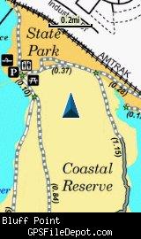
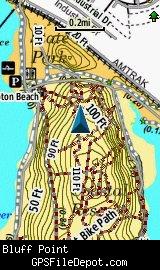
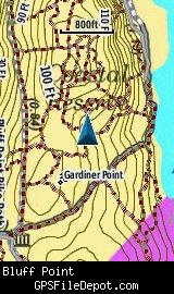
Screenshots
This KMZ map is set to Draw Order 40 so it will show 'beneath' your primary map but above my map of Haley Farm State Park on your Garmin KMZ-compatible GPS.
The image on the left is from a Garmin GPSMAP 78sc with no other maps displayed. The center and right images are from the same device with the Garmin 24K NE series TOPO map displayed. Note that the Garmin 24K TOPO map has MORE trails for this property than my KMZ map has.
Download
I have posted this KMZ as freeware, so instead of paying me for it, send me a note if you found this file helpful!
[email protected]
 Download Garmin Custom Map [268kB] (1126 Downloads)
Once you have downloaded and unzipped the KMZ file, you can:
1) Display it on your Garmin GPS receiver by placing the file in the \Garmin\CustomMaps folder on your supported Garmin GPS receiver. For a list of supported devices, click here.
2) Display it in Google Earth by opening the file (FILE, OPEN).
Notification of Updates
If you would like to be notified when I update this or any of my KMZ maps, subscribe to my notification e-mail service by sending an e-mail to [email protected] with the subject line "subscribe gps_maps"
This is a notification list only, and the only posts you will receive are when my KMZ maps are updated. Your e-mail address will not be used for any other purpose (or provided to anyone else except me).
Support The Effort
If you find the map and this website useful please consider making a donation to offset hosting costs.
* You don't need paypal to donate but that is who will process the donation.
Version History
Version 1.00 (2012 Sep 1)
Initial release using CT DEP map dated August 20, 2009.