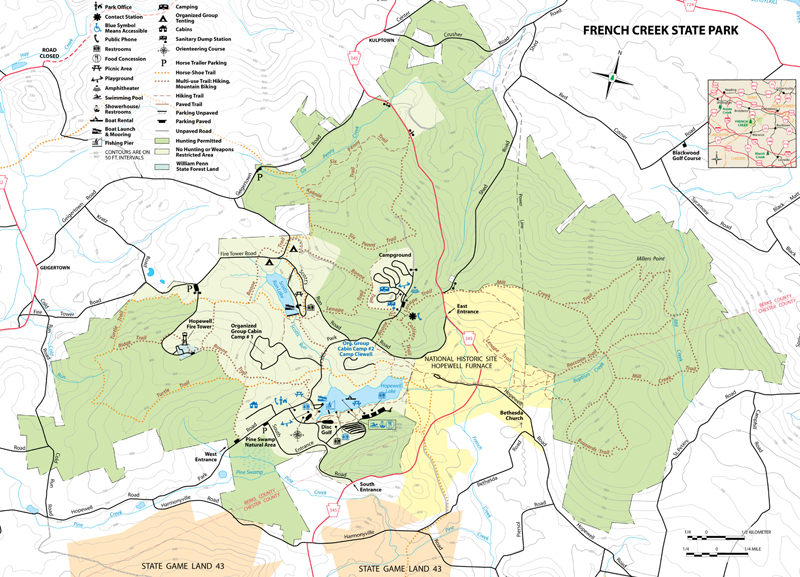
French Creek State Park (PA) Map
Created By: Pierre
Last Updated: May 13th, 2010 10:05am
Map Coverage:
North: 40.2261°
West: -75.8544°
East: -75.7115°
South: 40.1698°
Country: United States
State: Pennsylvania
Price: 0
![]()
![]()
![]()
![]()
![]()
![]()
![]()
![]()
Most Popular Maps
- My Trails-High Quality Trail and POI Maps
- Arizona Topo
- World Topo - Eastern
- Florida Topo
- WV-VA-KY Feb 3 2025 Public Map
Other Maps By Pierre (See All)
Raster map of French Creek State Park. Including trails, roads, points of interest, etc. This map is created from the official PDF map of the park and then converted to .kmz by GRaster.
 Download Garmin Custom Map [6MB] (3991 Downloads)