Commonwealth of the Northern Mariana Islands TOPO Map
Created By: Indrid Cold
Last Updated: November 21st, 2009 12:11pm
Map Coverage:
North: 21°
West: 144°
East: 147°
South: 14°
Country: Northern Mariana Islands
Price: Free!
![]()
![]()
![]()
![]()
![]()
![]()
![]()
![]()
![]()
Most Popular Maps
- My Trails-High Quality Trail and POI Maps
- Arizona Topo
- World Topo - Eastern
- WV-VA-KY Dec-29 2025 Public Map
- Florida Topo
Other Maps By Indrid Cold (See All)
Introduction
The purpose of this map is to provide topographic map coverage of the Commonwealth of the Northern Mariana Islands.
Features
- 2009 transportation & hydrography
- GNS Points of Interest, including available undersea features
- 50 foot topographic contours
- 600 foot bathymetric contours
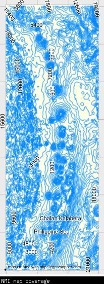
Coverage & Detail

Installation
Two options exist;
for Windows, download and run setup. The map will then appear in Garmin MapSource and can be added to your GPS by selecting it in MapSource and sending it to the GPSr.
For OS X, download the Mac .tgz version, double click it to extract it and then double click the .gmapi file. Map Manager will then install the map for you...
 Download Windows Version [1MB] (1570 Downloads)
Download Mac Version [1MB] (1041 Downloads)
Need MapSource (Windows)? Click Here
Need RoadTrip/MapInstall/MapManager (Macintosh)? Click Here
GPS Usage
This map can be installed with any other Garmin Maps via Garmin MapSource or MapInstall (MapSource How-To Tutorial).
References
Map data source:
- BODC
- NASA
- NGA
- U.S. Census Bureau
- USGS
Changelog
Version 1.00 (11 Nov 09)
- Initial release