Alaska Garmin Compatible Maps
Welcome to the list of Garmin compatible maps for Alaska, USA. Click on a row for more info about a given map or filter the list to get exactly what you want.
Filter Results:
You can limit the list below to just maps containing the features you want by checking or unchecking these boxes and hitting Filter:
Map Name


The map analyzes all available OSM data to display paved roads separately from unpaved roads; tracks and service roads that are open to motorcycles separately from those that are closed to motorcycles; and track grades, surface warnings, narrow roads, weir crossings, ford crossings, protected areas, footpaths, and steep terrain (as contour lines). The map is intended for adventure motorcycling, both on and off road, but it also works for cars, 4x4s, ATVs, and pedestrians, with the respective Garmin setting. The map does not display mountain bike and bridle trails unless they also permit motorcycles or pedestrians. The map includes an optional overlay of the Trans Australia Trail. There is a contact form on the download page in case of any queries.
View Map Details/Download
View Map Details/Download
This Transparent map will allow you to add a layer to your GPS showing the boundaries of Big Game Management Units in Alaska. Use the map to see your position relative to Big Game Management Unit boundaries in the field or determine which GMU you are standing in. Turn this layer on and off as needed. Use this transparent map in conjunction with other map products
Updated in 2011
View Map Details/Download
View Map Details/Download
Topo map of most of Alaska for Garmin GPSr units
View Map Details/Download
View Map Details/Download
Version 0.08 (May 11, 2009):
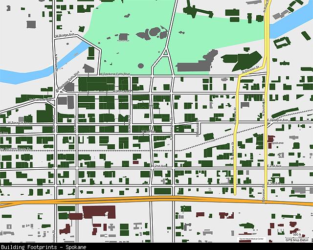
This transparent mapset can overlay other mapsets loaded into your GPS and displays shaded polygons representing the footprints of buildings in cities that have offered this data for public use on their web sites. The cities currently included are:
* Seattle, WA (full coverage, limited differentiation between building types, no building names)
* Spokane, WA (full coverage, no building names)
* Bellevue, WA (full coverage with some overlap into Redmond et al., limited differentiation between building types, few building names)
* Kitsap County, WA (full coverage, limited differentiation between building types, no building names)
* Bellingham, WA (full coverage, limited differentiation between building types)
* Anchorage, AK (no residential buildings)
View Map Details/Download
View Map Details/Download
Newly Updated! Download over 55 custom waypoint icons specifically designed for hunting in the west. now you'll be able to mark your bull or cow elk with an actual bull or cow elk symbol. There is also deer, bighorn sheep, bear, wolf, moose, animal tracks, blood trail, and much more! Compatible with most new and older generation Garmin mapping GPS units! The free download, screenshots, and instructions can be found on the website!
View Map Details/Download
View Map Details/Download
Version 1.77 (April 26, 2013):
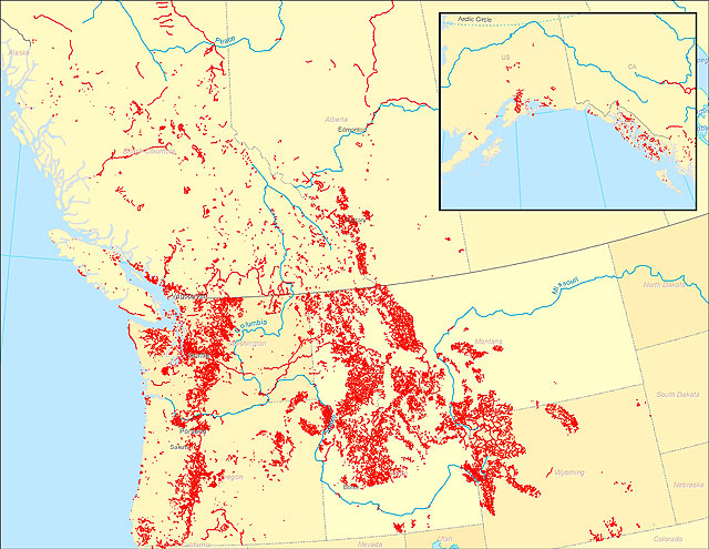
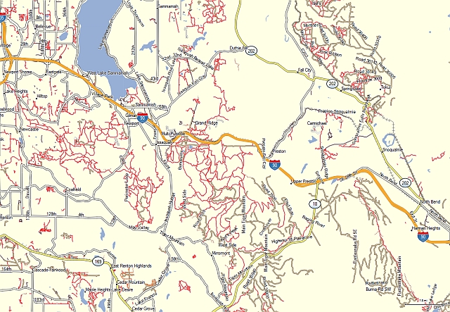
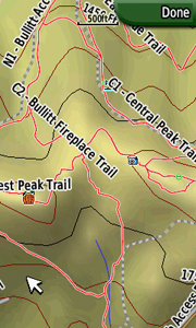
A transparent map offering trail coverage in the Northwest United States (Washington, Idaho, Oregon, Montana, Wyoming, and Alaska) as well as British Columbia and Alberta, Canada. It also includes the full length of the Pacific Crest Trail through California to the Mexico border. Custom types are used to help distinguish trail types: regular dirt trails, minor trails, paved trails, motorized/ATV trails, along with unpaved roads and paved roads that aid in navigation to trail sites.
Discussion related to this mapset can be found at the
Switchbacks.com Forum.
View Map Details/Download
View Map Details/Download
Road map of USA created from OpenStreetMap data.
This is experimental map. It is a result of an attempt to create a map for Garmin with reasonable routing on long distances. Map size is about 3GB.
View Map Details/Download
View Map Details/Download
Detailed map of USA for Garmin GPS, based on OpenStreetMap data. Full map is about 9GB, it can be downloaded as a whole mapset or smaller regions. Maps can be installed under Windows or Mac OSX.
SRTM contour lines 25m, NOAA depth contours, USGS Landcover Woodlands.
View Map Details/Download
View Map Details/Download
US Planimetric (non-contour) Alaska esatern hemisphere
View Map Details/Download
View Map Details/Download
US Planimetric (non-contour) for Alaska and Hawaii
View Map Details/Download
View Map Details/Download
Map of all the states and counties in the United States. This is a transparent map meant to overlay other maps.
View Map Details/Download
View Map Details/Download
Topo Map of Alaska
View Map Details/Download
View Map Details/Download
Note: A ![]() symbolizes an external link. That means it is not hosted by or provided by GPSFileDepot.
symbolizes an external link. That means it is not hosted by or provided by GPSFileDepot.