Moun10Bike's Garmin Compatible Maps
Welcome to the database of Garmin compatible maps provided by Moun10Bike. To see other maps either go to our maps page or check out other users' maps.
Filter Results:
You can limit the list below to just maps containing the features you want by checking or unchecking these boxes and hitting Filter:
Map Name


Version 0.08 (May 11, 2009):
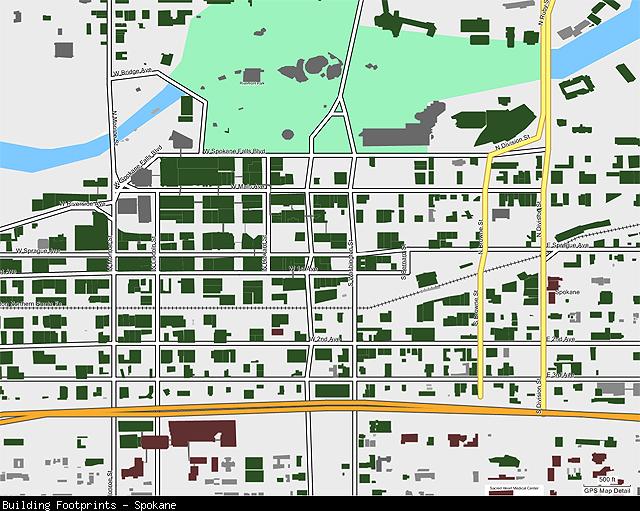
This transparent mapset can overlay other mapsets loaded into your GPS and displays shaded polygons representing the footprints of buildings in cities that have offered this data for public use on their web sites. The cities currently included are:
* Seattle, WA (full coverage, limited differentiation between building types, no building names)
* Spokane, WA (full coverage, no building names)
* Bellevue, WA (full coverage with some overlap into Redmond et al., limited differentiation between building types, few building names)
* Kitsap County, WA (full coverage, limited differentiation between building types, no building names)
* Bellingham, WA (full coverage, limited differentiation between building types)
* Anchorage, AK (no residential buildings)
View Map Details/Download
View Map Details/Download
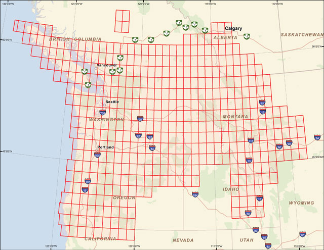
Version 0.24 (April 26, 2013):
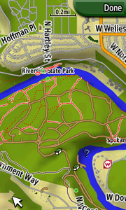
A mapset containing contours, hydrology, roads, trails, points of interest and more for all of Washington State, plus growing portions of Oregon, Idaho, Montana, British Columbia, and Alberta.
View Map Details/Download
View Map Details/Download
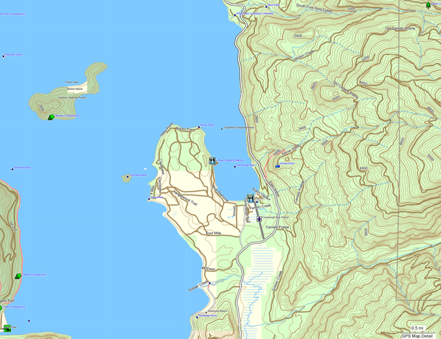
Version 1.77 (April 26, 2013):
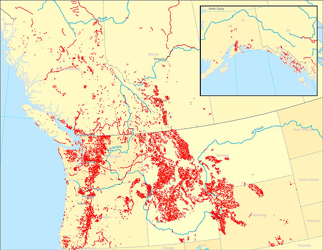
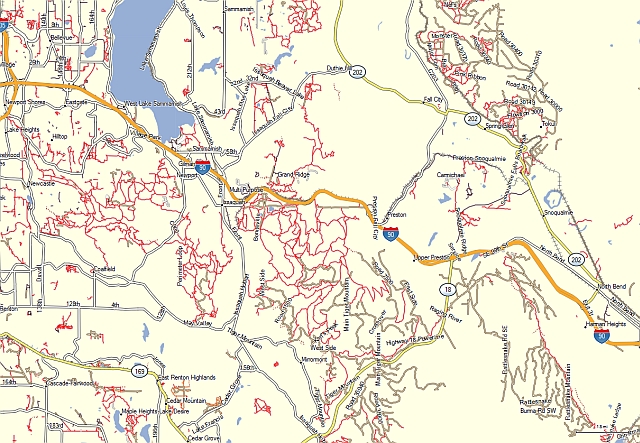
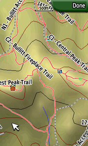
A transparent map offering trail coverage in the Northwest United States (Washington, Idaho, Oregon, Montana, Wyoming, and Alaska) as well as British Columbia and Alberta, Canada. It also includes the full length of the Pacific Crest Trail through California to the Mexico border. Custom types are used to help distinguish trail types: regular dirt trails, minor trails, paved trails, motorized/ATV trails, along with unpaved roads and paved roads that aid in navigation to trail sites.
Discussion related to this mapset can be found at the
Switchbacks.com Forum.
View Map Details/Download
View Map Details/Download
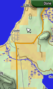
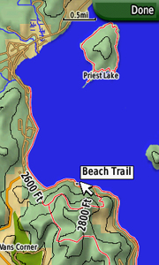
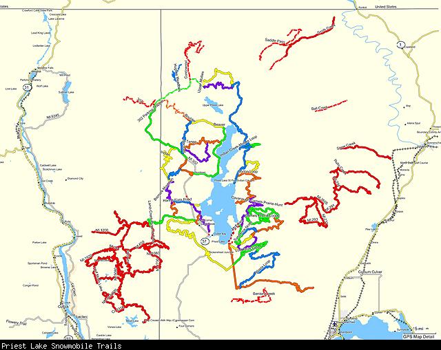
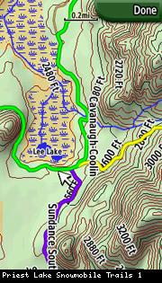
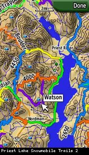
The mapset currently covers all of the snowmobile trails within the Priest Lake Ranger District along with the connector trails between Priest Lake and Schweitzer. Trails have been named and color-coded to match the official Priest Lake groomer map. The mapset is transparent and can be overlaid over other mapsets on the GPS, including the companion Priest Lake Topo mapset.

View Map Details/Download
View Map Details/Download
Note: A ![]() symbolizes an external link. That means it is not hosted by or provided by GPSFileDepot.
symbolizes an external link. That means it is not hosted by or provided by GPSFileDepot.