Jalalabad TOPO Map
Created By: Indrid Cold
Last Updated: December 6th, 2009 3:12pm
Map Coverage:
North: 35°
West: 70°
East: 71°
South: 34°
Country: Afghanistan, Pakistan
Price: Free!
![]()
![]()
![]()
![]()
![]()
![]()
Most Popular Maps
- My Trails-High Quality Trail and POI Maps
- Arizona Topo
- World Topo - Eastern
- Florida Topo
- World shaded relief kmz
Other Maps By Indrid Cold (See All)
This map superseded by http://www.gpsfiledepot.com/maps/view/182/
Introduction
The purpose of this map is to provide map coverage of Jalalabad and the surrounding area.
Features
- Roads, settlements and water data including irrigated areas.
- Points of Interest, such as Med centers, summits, ranges, valleys, passes...
- 20 foot topographic contours
- English Transliteration, not: جلالکوټ، جلال ابا
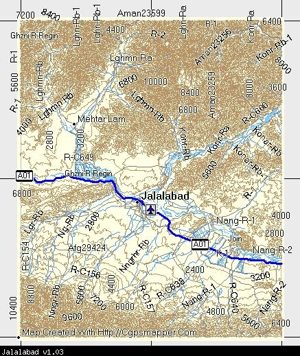
Coverage & Detail
The following MapSource screenshot shows the coverage:
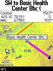
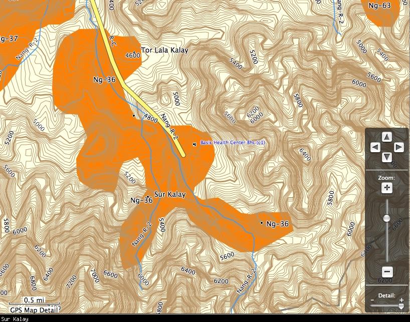
GPS screen shots showing detail:
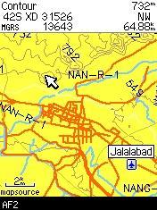
Closeup of Sur Kalay from RoadTrip:
Installation
Two options exist;
for Windows, download and run setup. The map will then appear in Garmin MapSource and can be added to your GPS by selecting it in MapSource and sending it to the GPSr.
For OS X, download the Mac .dmg version, double click it to mount the file. Instructions are in the Read First file.
 Download Windows Version [142B] (1793 Downloads)
Download Mac Version [142B] (1007 Downloads)
Need MapSource (Windows)? Click Here
Need RoadTrip/MapInstall/MapManager (Macintosh)? Click Here
GPS Usage
This map can be installed with any other Garmin Maps via Garmin MapSource or MapInstall (MapSource How-To Tutorial).
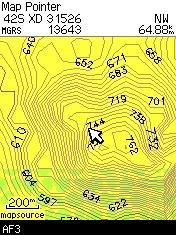
Outcrop on Jalalabad highway:

Changelog
Version 1.04 (20 Dec 08)
- Set levels to match new mapsets.
- Removed diacritics that didn't display properly on some Garmin units.
- Complete rebuild of NGA set.
- New Macintosh installer.
Version 1.03 (27 Nov 08)
- Highway labels display
- Road TYPE and labels
- Adjusted levels of POI's (now the overview doesn't look like a bunch of summits and villages
- Population data applied to major populated places
Version 1.02 (12 Nov 08)
- Updated NGA nameset (Includes POI's over the Durand Line)
- Transliteration includes alternative placenames (POI's can search all name sets)
- TYPE and level updates
- Windows version now available
Version 1.01 (09 Nov 08)
- Changed river_lands type for better display
Version 1.00 (09 Nov 08)
- Initial release