Peaslee Wildlife Management Area Map
Created By: Boyd
Last Updated: December 4th, 2009 6:12pm
Map Coverage:
North: 39.474°
West: 75.0002°
East: 74.7733°
South: 39.2749°
Country: United States
State: New Jersey
Price: free
![]()
![]()
![]()
![]()
![]()
![]()
![]()
![]()
Most Popular Maps
- My Trails-High Quality Trail and POI Maps
- Arizona Topo
- World Topo - Eastern
- Florida Topo
- World shaded relief kmz
Other Maps By Boyd (See All)
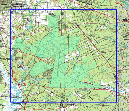
This .kmz file contains a USGS 1:24000 topo map of the Peaslee Wildlife Management Are and immediate surroundings in Southern New Jersey The map covers and area about 12.2 miles x 13.7 miles at a resolution of ~8 feet per pixel.
These maps are only compatible with the Garmin Oregon, Dakota and Colorado series using the current firmware. If your unit does not recognize this map, connect it to your computer and run Garmin WebUpdater to install the newest firmware.
This file is compatible with both Macs and Windows machines. Simply drop it into your CustomMaps folder on the GPS. The CustomMaps folder must be inside the Garmin folder and may be located either in internal memory or on a storage card.
This file can also be viewed with Google Earth, or any other software which supports .kmz files. Not compatible with Mapsource.
Screenshots below are from an Oregon 400


 Download Garmin Custom Map [11MB] (1459 Downloads)