Idaho Garmin Compatible Maps
Welcome to the list of Garmin compatible maps for Idaho, USA. Click on a row for more info about a given map or filter the list to get exactly what you want.
Filter Results:
You can limit the list below to just maps containing the features you want by checking or unchecking these boxes and hitting Filter:
Map Name


Amtrak Tracks
View Map Details/Download
View Map Details/Download
This expanded Desert Southwest map extends from Yosemite on the west to Joshua Tree on the south, Yellowstone in the north, and stays at Mesa Verde on the east. IT WILL OVERWRITE ANY DESERT SOUTHWEST MAP CURRENTLY ON YOUR SYSTEM. This map is routable, but most of the data has been created by OSM volunteers, so please use it with care.
View Map Details/Download
View Map Details/Download
This mapset is for Garmin Oregon/Colorado/Dakota GPS users who have City Navigator maps and want to navigate at night without glare. Enable this map when the sun goes down for a Night Mode similar to the Nuvi's.
View Map Details/Download
View Map Details/Download
Newly Updated! Download over 55 custom waypoint icons specifically designed for hunting in the west. now you'll be able to mark your bull or cow elk with an actual bull or cow elk symbol. There is also deer, bighorn sheep, bear, wolf, moose, animal tracks, blood trail, and much more! Compatible with most new and older generation Garmin mapping GPS units! The free download, screenshots, and instructions can be found on the website!
View Map Details/Download
View Map Details/Download
Transparent Garmin overlay map showing the close approximate path, centerline, and boundaries of the annular solar eclipse of October 14, 2023.
View Map Details/Download
View Map Details/Download
Transparent overlay map showing the close approximate path, centerline, and boundaries of the total solar eclipse of August 21, 2017.
View Map Details/Download
View Map Details/Download
This gravitational model is complete to spherical harmonic degree and order 2159, and contains additional coefficients extending to degree 2190 and order 2159.
View Map Details/Download
View Map Details/Download
This download contains a Garmin POI file with the locations and descriptions of Geodetic Control Points in Montana and Idaho.
View Map Details/Download
View Map Details/Download
A total US street map based on the 2007 census data. This map is free, and I intend for it to remain so. GPSFileDepot offers an exclusive mac version for download.
View Map Details/Download
View Map Details/Download
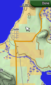
This Transparent map will allow you to add a layer to your GPS showing the boundaries of Big Game Management Units in Idaho. Use the map to see your position relative to Game Management Unit boundaries in the field. Turn this layer on and off as needed. Use this transparent map in conjunction with other map products such as our BLM4GPS state maps, Topo USA, or a preloaded Topo Basemap.
Now Updated to 2018
View Map Details/Download
View Map Details/Download
This transparent map will allow you to add a layer to your GPS showing the boundaries of Elk Management Units in Idaho. Use the map to see your position relative to Elk Game Management Unit boundaries in the field or determine which GMU you are standing in. Turn this layer on and off as needed. Use this transparent map in conjunction with other map products.
Updated in 2018
View Map Details/Download
View Map Details/Download
Idaho Land Ownership HIGH DETAIL - COLORIZED
View Map Details/Download
View Map Details/Download
Converted from OpenStreetMap data collected on June 12th, 2015
View Map Details/Download
View Map Details/Download
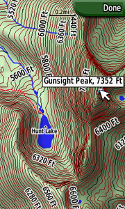
A 24k quality topo map including contours lines, roads, trails, points of interest, and high resolution water data for the entire state of Idaho. For mac and windows.
View Map Details/Download
View Map Details/Download
* Roads - Interstates, highways, arterial roads, residential roads, limited unpaved roads
* Railroads
* High resolution water data - lakes, rivers, streams, and washes
* Federal Land Usage - Wilderness area, national parks, and military bases/ranges, native american reservations
* Borders - County and state boundary lines
* Elevation contours - 20ft intervals
* GNIS Points of Interest - summits, mines, falls, dams, cemeteries, towers, populated places, etc.
* 4 Grid Segments to the dergee - no segment larger than 6.7mb most less then 4mb in size
View Map Details/Download
View Map Details/Download
PRODUCT OVERVIEW:
An essential tool for your GPS, these fast, intuitive topo maps highlight all types of public lands. With this map you can easily determine your position in relation to public or private property boundaries, find new access, enjoy 24K topo, locate hunting unit boundaries, and we are just getting started! Endorsed by numerous State and Federal agencies, our maps are the most reliable source for land ownership maps on the market.
Map Key Features
Have the confidence in the field to be a better hunter and make ethical decisions. Our Maps have the same look and feel as standard BLM maps but with additional features:
- Color coded public and private lands
- 24K topographic functionality
- Section lines and numbers
- Roads (hwy, city, back-roads, trails)
- Water data (lakes, rivers, creeks, springs)
- National Forest roads and trails
- Geographic features and names
- Game Management or Hunting Units
- State specific features (WMA, WPA, CWMU) onXMaps web page for Hunt Northwest Regional Map
- Discover little-known, seldom-hunted public land.
- Navigate confidently around private lands you're not allowed to hunt.
- Easily identify big game hunting unit boundaries.
View Map Details/Download
Version 0.24 (April 26, 2013):
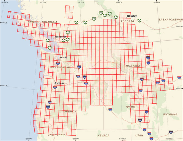
A mapset containing contours, hydrology, roads, trails, points of interest and more for all of Washington State, plus growing portions of Oregon, Idaho, Montana, British Columbia, and Alberta.
View Map Details/Download
View Map Details/Download
Version 1.77 (April 26, 2013):
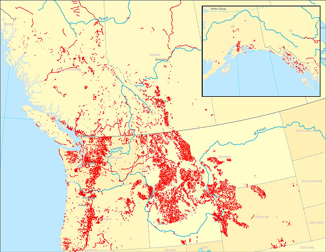
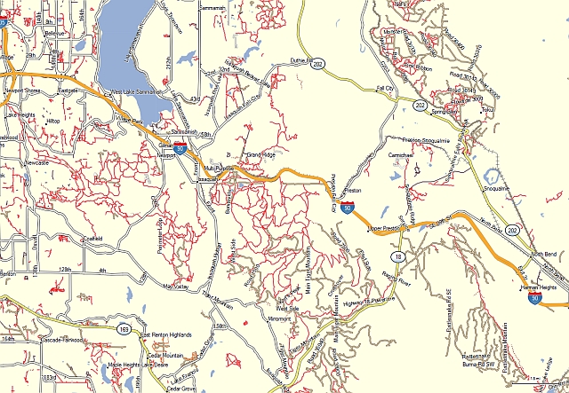
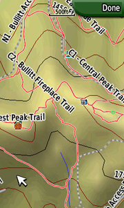
A transparent map offering trail coverage in the Northwest United States (Washington, Idaho, Oregon, Montana, Wyoming, and Alaska) as well as British Columbia and Alberta, Canada. It also includes the full length of the Pacific Crest Trail through California to the Mexico border. Custom types are used to help distinguish trail types: regular dirt trails, minor trails, paved trails, motorized/ATV trails, along with unpaved roads and paved roads that aid in navigation to trail sites.
Discussion related to this mapset can be found at the
Switchbacks.com Forum.
View Map Details/Download
View Map Details/Download
An overlay mapset of the US Public Land Survey System (PLSS) grid.
View Map Details/Download
View Map Details/Download
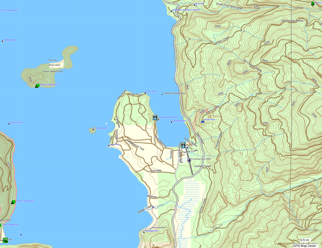
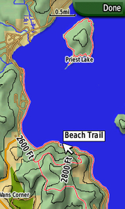
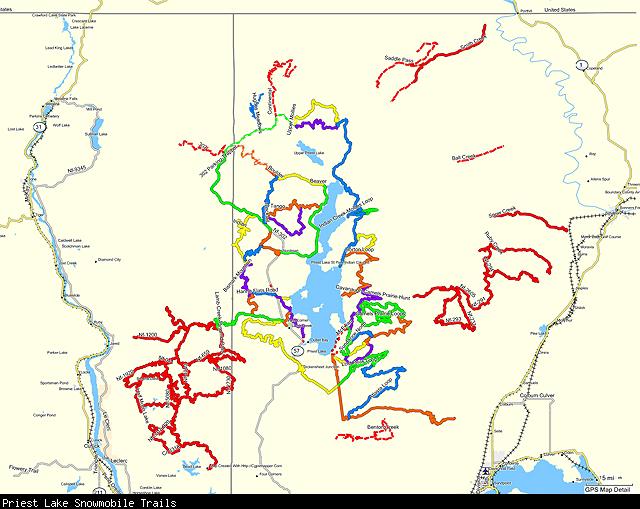
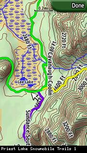
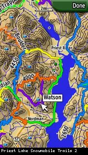
The mapset currently covers all of the snowmobile trails within the Priest Lake Ranger District along with the connector trails between Priest Lake and Schweitzer. Trails have been named and color-coded to match the official Priest Lake groomer map. The mapset is transparent and can be overlaid over other mapsets on the GPS, including the companion Priest Lake Topo mapset.

View Map Details/Download
View Map Details/Download
PRODUCT OVERVIEW:
An essential tool for your GPS, these fast, intuitive topo maps highlight all types of public lands. With this map you can easily determine your position in relation to public or private property boundaries, find new access, enjoy 24K topo, locate hunting unit boundaries, and we are just getting started! Endorsed by numerous State and Federal agencies, our maps are the most reliable source for land ownership maps on the market.
Map Key Features
Have the confidence in the field to be a better hunter and make ethical decisions. Our Maps have the same look and feel as standard BLM maps but with additional features:
- Color coded public and private lands
- 24K topographic functionality
- Section lines and numbers
- Roads (hwy, city, back-roads, trails)
- Water data (lakes, rivers, creeks, springs)
- National Forest roads and trails
- Geographic features and names
- Game Management or Hunting Units
- State specific features (WMA, WPA, CWMU) onXmaps web page for Hunt Rockies North Regional Map
- Discover little-known, seldom-hunted public land.
- Navigate confidently around private lands you're not allowed to hunt.
- Easily identify big game hunting unit boundaries.
View Map Details/Download
An overlay mapset of trails from the USGS DLG/SDTS 100K files.
View Map Details/Download
View Map Details/Download
Road map of USA created from OpenStreetMap data.
This is experimental map. It is a result of an attempt to create a map for Garmin with reasonable routing on long distances. Map size is about 3GB.
View Map Details/Download
View Map Details/Download
Detailed map of USA for Garmin GPS, based on OpenStreetMap data. Full map is about 9GB, it can be downloaded as a whole mapset or smaller regions. Maps can be installed under Windows or Mac OSX.
SRTM contour lines 25m, NOAA depth contours, USGS Landcover Woodlands.
View Map Details/Download
View Map Details/Download
US Planimetric (non contour) for the North West
View Map Details/Download
View Map Details/Download
Map of all the states and counties in the United States. This is a transparent map meant to overlay other maps.
View Map Details/Download
View Map Details/Download
Roads and Trails in Southern Idaho Version 3.0
View Map Details/Download
View Map Details/Download
Note: A ![]() symbolizes an external link. That means it is not hosted by or provided by GPSFileDepot.
symbolizes an external link. That means it is not hosted by or provided by GPSFileDepot.